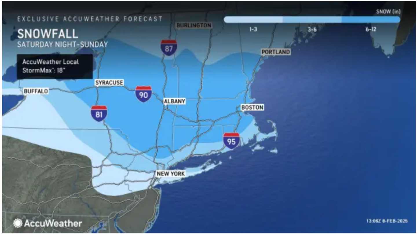
The quick-moving system will arrive Saturday night, Feb. 8, before winding down late Sunday morning, Feb. 9, according to the National Weather Service.
Click on the first image above from AccuWeather to see the latest predicted snowfall totals, which were released Saturday morning:
- 1 to 3 inches in the lightest shade of blue,
- 3 to 6 inches in the next shade,
- 6 to 12 inches in the darkest shade.
"Much of the snow will fall in a six- to 12-hour period from late Saturday to Sunday morning," AccuWeather says.
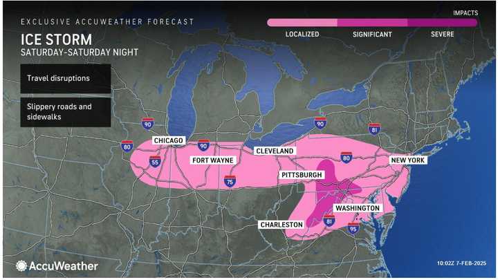
Locations where there will be mainly a wintry mix, including significant icing which could knock out power, are visible by clicking on the second image.
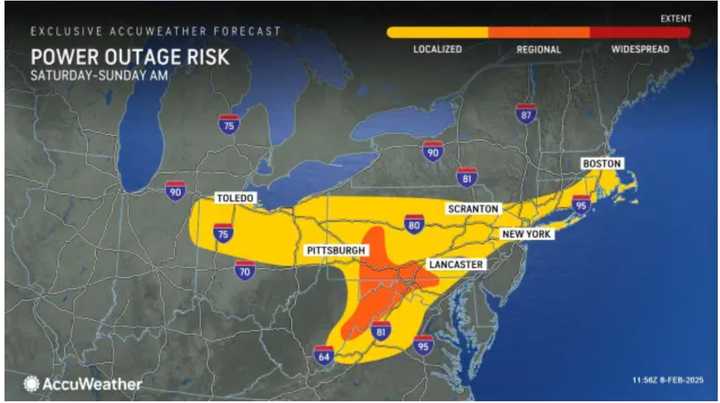
For areas most at risk for power outages, click on the third image above.
The most significant risk of icing, says AccuWeather Senior Meteorologist Bill Deger, "lies across a swath of eastern West Virginia, far northwestern Virginia, Maryland and south-central Pennsylvania, where more than 0.25 of an inch of ice buildup is expected. This can again lead to downed tree limbs and power outages,"
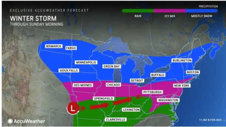
For precipitation types by region, click on the fourth image above.
Following the weekend system, the next storm is forecast to arrive Tuesday, Feb. 11, marking the beginning of an unsettled stretch in which two more new systems are expected.
Check back to Daily Voice for updates.
Click here to follow Daily Voice Castleton-Schodack and receive free news updates.