Temps will become more seasonable on Thursday, Jan. 2, with lingering strong winds making it feel colder.
From Friday, Jan. 3 to Sunday, Jan. 12, temperatures will be between 12 and 25 degrees below the historical average.
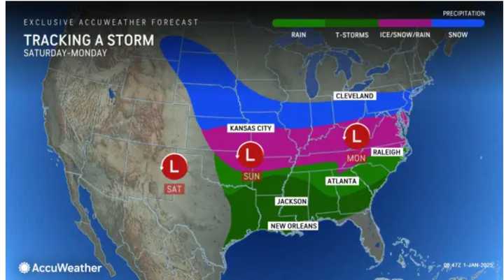
The return of colder air will set the stage for a massive storm that will move along a 1,500-mile-long zone from the Midwest to many areas of the Appalachians and the Atlantic coast from this weekend to early next week, according to AccuWeather meteorologists.
The system is expected to hit the East Coast on Monday, Jan. 6, with current models having it affecting areas farther south in the Northeast. (Click on the first image above from AccuWeather.)
"The storm is shaping up to be the first widespread cross-country winter storm of the season for the central and eastern United States and will negatively affect travel during the final days of the holiday break," says AccuWeather.
While it’s too early to predict snowfall totals, the system is expected to cause significant travel disruptions and hazardous conditions.
Check back to Daily Voice for updates.
Click here to follow Daily Voice Bloomingburg-Wurtsboro and receive free news updates.

