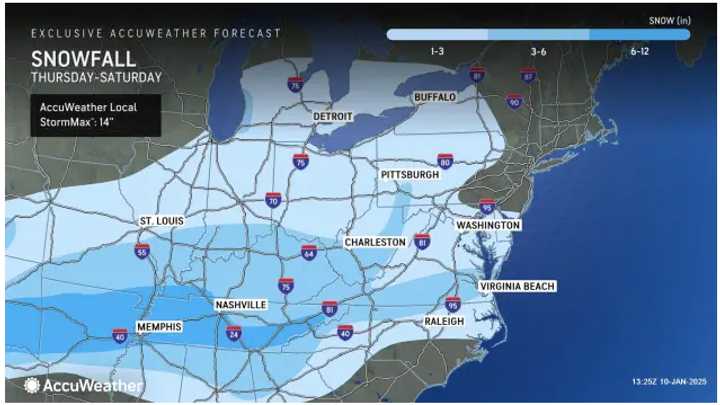
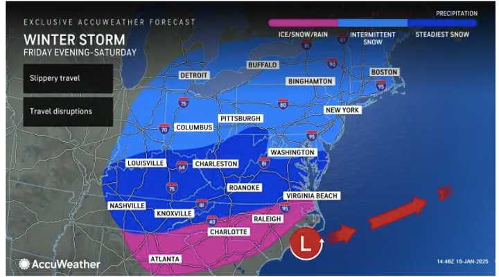
While the heaviest snowfall is expected south of Washington, DC, the storm will still cause slick travel throughout the region.
"While a general 1 to perhaps 3 inches of snow is forecast, there can be pockets where a coating or a dusting of snow could be all that falls from the storm, especially along the upper mid-Atlantic coast," AccuWeather Senior Meteorologist Brett Anderson said."
Snowfall Accumulation Projections
See the first image above
- Light Blue Areas: 1 to 3 inches
- Next Shade: Up to 6 inches
- Dark Blue Areas: Up to a foot
"Even with a light amount of snow, slow and slippery travel on the roads is anticipated, along with a significant number of airline delays due to de-icing operations," according to AccuWeather. "As aircraft and crews are displaced by the southern storm, the number of flight cancellations may climb even before the storm arrives in the Northeast."
Timing By Region
- Maryland-Virginia: Precipitation begins around 11 p.m. Friday, Jan. 10.
- Pennsylvania, New Jersey, New York, Connecticut, Rhode Island, and Massachusetts: Snow and sleet expected to start between 4 a.m. and 7 a.m. Saturday, Jan. 11.
A mix of precipitation is likely after daybreak on Saturday, with mostly cloudy skies lingering throughout the day.
The system will wind down by Saturday afternoon, although flurries could persist in some areas into the evening.
Looking ahead, Sunday, Jan. 12, will bring sunny skies with temperatures in the mid to upper 30s.
Check back to Daily Voice for updates.
Click here to follow Daily Voice Phillipsburg and receive free news updates.

