Subscribe
55°

Tornado Watch Issued In Ocean County; Severe Thunderstorm Watch Issued For All 21 NJ Counties
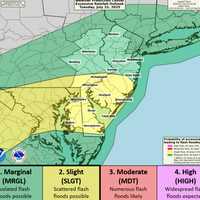
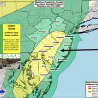
A Severe Thunderstorm Watch is in effect for all 21 counties through 9 p.m., with forecasters warning of damaging wind gusts and heavy downpours. Flash Flood and Heat Advisories also remain in place as of Tuesday afternoon, the National Weather Service said.
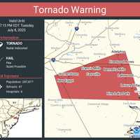
In Ocean County, a Tornado Warning was issued just before 6:30 p.m. and remains in effect until 7:15 p.m. Tuesday. Radar indicated potential tornadic activity over areas including Lakewood, Cassville, Pine Lake Park, Leisure Village, New Egypt, and Hornerstown.
As of 7 p.m., more than 6,800 customers were without power. According to JCP…
NWS Confirms 80 MPH Winds In NJ Storm That Left 3 Dead
The National Weather Service says the severe storm that struck parts of Central Jersey Thursday, July 3, packed winds as strong as 80 miles per hour and caused widespread damage across multiple towns.
In a public information statement issued Friday afternoon, July 4, the NWS confirmed that the destruction — which caused three deaths — was caused by “straight-line winds and downbursts.”
The storm hit Somerset and Middlesex counties just after 6 p.m., tearing through North Plainfield, South Plainfield, Green Brook Township, Bound Brook, and Metuchen, the NWS said.
“Based on photos shared wit…
More Than 10K Lose Power As NJ Swelters In 106° Heat
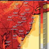
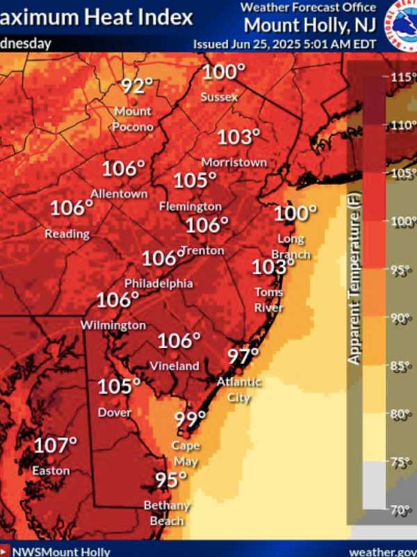
New Jersey is sweltering under dangerously high heat and humidity, with feels-like temperatures hitting 106° in multiple cities on Wednesday, June 25, according to the National Weather Service in Mount Holly.
Trenton, Vineland, Allentown, Philadelphia, and Wilmington all reached peak heat indices of 106°, while Easton, PA, topped out at 107°, weather officials said. Long Branch and Sussex hit 100°, and Toms River wasn’t far behind at 103°.
To make matters worse, more than 10,000 residents across the state were without power as of 7:30 p.m., making it even harder to cool off:
PSE&G outa…
Tornado Risk, 70 MPH Winds, 100° Heat: NJ Braces for Explosive Weather Outbreak (Timing)
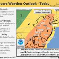
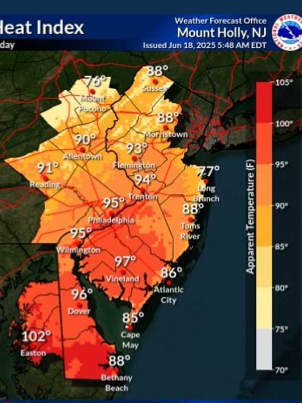
New Jersey is facing a one-two weather punch Thursday, June 19 (Juneteenth): dangerous heat and the threat of severe storms, the National Weather Service warns.
High temperatures in the low 90s, paired with tropical humidity, could push the heat index to 100 degrees across much of the state, especially south of I-78, according to the Mount Holly Forecast Office. Conditions are expected to peak Thursday, June 19, between 4 p.m. and 10 p.m.
"High temperatures in the low 90s combined with high humidity will lead to heat indices reaching 95–100 degrees," forecasters said in the latest alert. "D…
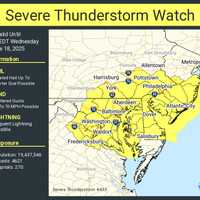
Severe Thunderstorm Watch In Effect For 10 NJ Counties, NWS Warns
A Severe Thunderstorm Watch is in effect for 10 New Jersey counties through 7 p.m. Wednesday, June 18, as damaging storms threaten to slam the region with hail, wind, and lightning, according to the National Weather Service.
The counties under watch include:
Atlantic, Burlington, Camden, Cape May, Cumberland, Gloucester, Mercer, Monmouth, Ocean, and Salem.
The Storm Prediction Center says conditions are right for frequent lightning, heavy downpours, and wind gusts strong enough to cause property damage and power outages.
Meanwhile, residents in northeast New Jersey—including Passaic, Berg…
Middlesex County Faces Air Quality Alert As Temps Climb Into 90s Thursday
It’s not just hot — it’s hazardous.
Air quality across New Jersey and New York is expected to be unhealthy for sensitive groups on Thursday, June 12, as temperatures climb into the 90s and Code Orange Alerts are in effect.
Health officials say that ground-level ozone and fine particulates will combine with heat to pose risks for children, seniors, and people with heart or lung conditions.
⚠️ Air Quality Alerts
Code Orange Air Quality Alerts issued by the NJ Department of Environmental Protection
Counties affected: Bergen, Essex, Union, Hudson, Passaic, Middlesex, Mercer, Ocean, Burling…