Middletown
Port Monmouth
Lincroft
Leonardo
Your Local News for Middletown, Port Monmouth, Lincroft and Leonardo
Subscribe
Subscribe
Wednesday, oct 7
61°
Breaking News
Your Community
On Your Side
National Interest
Trending
Events
Weather
Obituaries
Jobs
Advertise
Find Your Daily Voice
GO
Middletown
Port Monmouth
Lincroft
Leonardo
Subscribe
Breaking News
Your Community
On Your Side
National Interest
Trending
Events
Weather
Obituaries
Legal
Tags
Jobs
Shop
Sponsored Content
Support Us
Home
About us
All sites
Advertise with us
Contact us
Terms of use
Privacy policy
Code of ethics
Site Map
© 2026 Daily Voice LLC
61°
Wednesday, oct 7
Weather
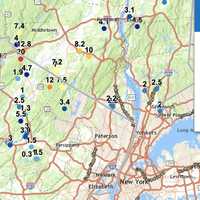
Snow Totals Climb With 20 Inches Recorded In This NJ Town: Check How Much Snow Your Area Got
Snowfall totals in New Jersey and Pennsylvania have surged higher than earlier reports, with some areas now measuring up to 20 inches, the National Weather Service announced Friday, Nov. 22. High Point, NJ, has officially recorded 20 inches of snow as of Friday morning, marking the highest total in the region. In Pennsylvania, Richmondale follows closely with 19.5 inches, and Cortez reached 19 inches, highlighting the storm's significant impact on higher elevations. Other notable totals include 17.2 inches near Uniondale and 17 inches in Clifford, both in northeastern Pennsylvania. F…
Weather
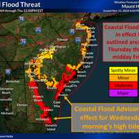
Coastal Flooding Expected Midweek In New Jersey As Rising Tides Pose Threat
The National Weather Service is warning New Jersey residents of potential coastal flooding impacts this week, with conditions expected to worsen midweek. Minor flooding is likely to occur with high tide Wednesday morning, Nov. 13, while Thursday and Friday could see widespread minor to moderate flooding during early morning tides. A weather map indicates minor flooding may impact areas from Perth Amboy to Beach Haven, with moderate flooding expected from Atlantic City to Cape May. Minor flooding is also possible in Philadelphia. Residents in coastal areas are urged to prepare for pos…
Weather
Brief Cold Front Coming, Warm Weather Sticking Around In NJ, PA: Forecasters
A cold front will end the summer-like warmth in the Northeast — for now, forecasters say. "For the next seven to 10 days at least, warm days will outnumber chilly ones, relative to the historical average," AccuWeather Senior Meteorologist Brett Anderson said. "This means that when all the days are tallied up, temperatures will be several degrees above that historical average, which is slowly trending downward during November." The last few days have certainly felt like summer, but the weekend will be feeling more like autumn, forecasters say. Temperatures on Friday will be in the high 70s …
Weather
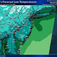
Freeze Warning: Temps To Dip Into 40s Tonight Along NJ Coast
The cold and cozy nights are here to stay, with temps expected to dip into the 30s across parts of New Jersey and Pennsylvania Wednesday night, Oct. 16, but with summer-like temps expected over the weekend, forecasters said. While Wednesday will be sunny with a high just below 60, temperatures could plummet to the high-30s or low-40s in New Jersey and Greater Philadelphia come nightfall, the National Weather Service said. In the Poconos and the northernmost parts of NJ, temperatures could dip as low as 30, the NWS said. Temperatures won't be quite as low along New Jersey's coast, rangi…
Weather
Frost Advisory Issued Across NJ, PA On Coldest Day Of Fall So Far
Thursday, Oct. 10 has been the chilliest day of fall so far, the National Weather Service says. That's not saying much, as temps have been in the 70s and high-60s. Thursday was 60 degrees and sunny, and it's expected to get even cooler come nightfall, with a frost advisory issued across most of New Jersey and parts of Greater Philadelphia (see below). Today will be the coldest fall day of the season (so far)! Afternoon highs will be about 5-10° below average and... Posted by US National Weather Service Philadelphia/Mount Holly on Thursday, October 10, 2024 Temps could drop to 44 o…
Weather
Scorching Heat, Severe Storms: Your Forecast Leading Up To Labor Day In NJ, PA
The heat is going to ramp up before summer winds down in the Northeast. Heat advisories, warnings, and watches are in place this week across New Jersey and Pennsylvania as temperatures climb up to the high 90s, even feeling close to 100 degrees in some places, AccuWeather and the National Weather Service report. Tuesday, Aug. 27 is sunny with a high of 89 while Wednesday, Aug. 28 will be as hot as 97 degrees, the NWS said. According to AccuWeather, Real Feel temps could creep into the 90s on Tuesday, and up to 105 Wednesday. A heat advisory was in effect through 8 p.m. Wednesday for Bergen…
Weather
Hundreds Without Power In NJ, More Storms Possible Late In The Day
Thousands of New Jersey residents woke up Monday morning, Aug. 19 without power due to Sunday's storm. And according to the National Weather Service, more stormy weather could be on the way for later in the day. As of 6:40 a.m., JCP&L was reporting the most outages with the following areas without power: Clinton, 880; Branchville, 150; Hopatcong, 215; Long Branch/Asbury Park, 350; Lakewood, 265. The National Weather Service said Monday would be cloudy, but will become partly sunny by midday. "A cold front will then approach from the west causing isolated severe thunderstorms this…
Weather
Thunderstorms Possible For NJ, PA This Weekend But 'Not Total Washout,' Forecasters Say
A slow-moving eastward storm system means a chance of rain and thunderstorms this weekend across New Jersey and Pennsylvania. Accuweather says that a "total washout" is not likely in the east. This weekend turns unsettled as showers and some t-storms increase at times, especially each afternoon and evening. High... Posted by US National Weather Service Philadelphia/Mount Holly on Friday, August 16, 2024 However, "there will be enough rain and thunderstorms around to interfere with some outdoor plans, as well as slow travel and perhaps create dangerous conditions in some locations."…
Weather
Wildfire Smoke Drifting Into NJ/NYC: How Bad Will It Be?
If things looks fuzzier than usual, it wasn't your eyes focusing to adjust this morning. That was wildfire smoke is drifting from Canada into the Northeast, the National Weather Service said Wednesday morning, Aug. 14. "You may notice hazy skies today," the NWS New York office said. "It is coming from wildfire smoke, which has overspread across the area from north to south." While the smoke is expected to "stick around" for the next several days, forecasters are not expecting harmful impacts to the air quality, the NWS said. You may notice hazy skies today. It is coming from wildfire …
Weather
Northern Lights Dazzle New Jersey Residents (
Photos
)
While you were sleeping skies over the Northeast were aglow with bright pinks and purples. Some New Jersey residents were lucky enough to see the Northern Lights and the Perseid Meteor Shower, visible between 1:30 a.m. and 3 a.m. Monday, Aug. 12. Some of them lit up social media with their footage. Northern Lights in the New Jersey Pine Barrens at 2:30 am this morning, Beautiful!!!! pic.twitter.com/3pFM3Q2Mo4 — Randy🇺🇸🗽 (@docgoodloe) August 12, 2024 FINALLY!! hardly visible to the naked eye, but finally got my #northernlights in central NJ at 11:14 PM tonight. #auroraborealis pic.t…
Weather
Tornado Watch Shifts, Now Covers These Counties Across NJ, PA As Debby Creeps In
The National Weather Service has shifted its tornado watch across New Jersey and Pennsylvania as Hurricane Debby creeps in. In New Jersey, the tornado watch is in effect through 10 p.m. Friday, Aug. 9 and covers Bergen, Essex, Hunterdon, Mercer, Middlesex, Morris, Passaic, Somerset, Sussex, Union and Warren counties in North Jersey. In Pennsylvania, the tornado watch is issued in Lehigh, Northampton, Carbon, Monroe, and Bucks counties. The tornado threat for South Jersey has diminished since the initial watch was issued early Friday morning, which has since been canceled. AccuWeather Th…
Weather
Towns With The Most Rainfall In New Jersey
The National Weather Service has released the rainfall totals from the Tuesday, Aug. 6 storm. Residents across the Northeast woke up Wednesday, Aug. 7 to several inches of water — in some places, feet. Here are the towns that got the most amount of rain: Bergen County: Ridgewood 5.79 inches Bogota 5.60 inches Oakland 3.86 inches Leonia 3.81 inches Lyndhurst 3.77 inches Hillsdale 3.56 inches Hasbrouck Heights 3.42 inches Hackensack 2.9…
Next Page
Archive