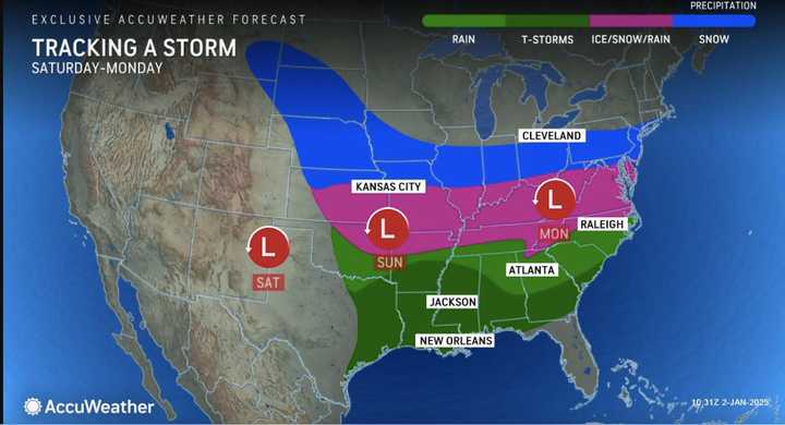
The system developing in Nebraska will move through the Midwest before arriving in much of the Northeast on Monday, Jan. 6.
“This is the first snow and ice storm of 2025, and we could see widespread impacts,” AccuWeather Chief On-Air Meteorologist Bernie Rayno said. “This storm will be far enough south to cause major problems in cities that may struggle to deal with wintry weather and ice. Arctic air will surge southward in the wake of this storm with subfreezing temperatures for millions of people.”
Current forecast models predict snow and ice for areas farther south in the Northeast, though the track could change. (See the first image above.)
Areas in the lightest shades of blue in the second image above should see between 1 to 6 inches of snowfall, with half a foot to a foot in the area in the darkest blue shade.
Major hubs in the storm’s zone for potential snow and ice include New York City, Philadelphia, Pittsburgh, and Baltimore, according to AccuWeather, which says 6 to 12 inches of snowfall is expected across a large 1,500-mile area extending to the Mid-Atlantic.
Check back with Daily Voice for updates.
Click here to follow Daily Voice Kinnelon and receive free news updates.

