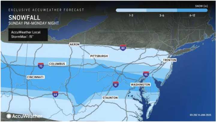
The storm, which began overnight, will bring significant snowfall to parts of the region Monday, Jan. 6. Accumulations are expected to reach up to 6 inches in southern New Jersey and southern Pennsylvania, with some areas in Maryland and Virginia receiving as much as a foot. (For final snowfall projections from AccuWeather, see the first image above.)
Hazardous icy travel is likely in many areas. (Click on the second image for details on affected regions.)
Following the storm, temperatures will remain dangerously cold throughout the week. Monday's high will hover in the mid-20s, though wind-chill values will make it feel 10 degrees colder.
According to the National Weather Service, temperatures may not rise above freezing until Sunday, Jan. 12.
"Prolonged heating demand, frozen pipes, dangerously low AccuWeather RealFeel Temperatures, and power outages can all occur this week," said AccuWeather Meteorologist Alex Duffus.
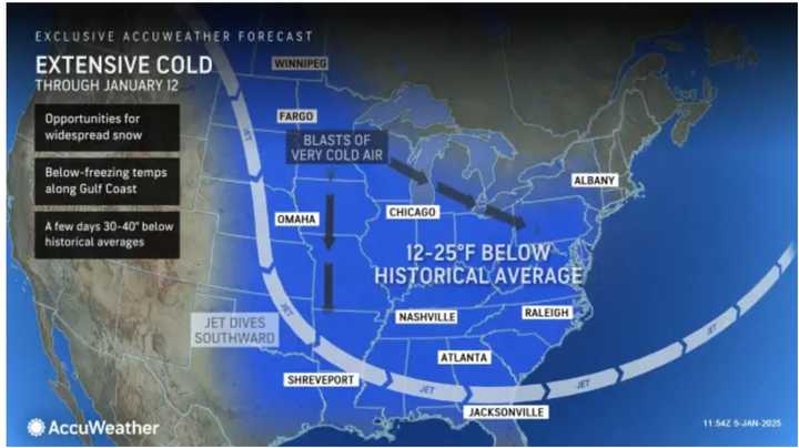
During this stretch, temperatures are forecast to be 12 to 25 degrees below average for this time of year. (See the third image above for details.)
Check back to Daily Voice for updates.
Click here to follow Daily Voice Hopatcong and receive free news updates.


