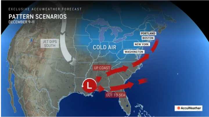
Forecast models have the storm on track for early next t week, with the current window from Monday, Dec. 9 to Wednesday, Dec. 11.
"Options for the storm as it nears the coast range from it evolving into a potent Nor'easter with significant travel disruptions to a weaker storm that simply races out to sea with minimal travel problems," according to AccuWeather.
See the first image above to see the two possible track scenarios.
"There continues to be an indication that a storm will track from the southern Plains or lower Mississippi Valley to the Atlantic coast from Dec. 9-11," said AccuWeather Senior Long-Range Meteorologist Joe Lundberg.
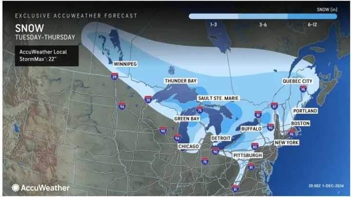
According to the National Weather Service, the timing for the first system's arrival along the East Coast from its origin in Alberta, Canada, is Wednesday night, Dec. 4, to Thursday, Dec. 5.
In the second image above from AccuWeather, a widespread 1 to 3 inches of snowfall is expected in locations in the lightest shade of blue, with areas farther inland expected to see 3 to 6 inches. Areas farther south will see mainly snow showers.
The days before the system's arrival will be dry and blustery, with temperatures ranging from about 5 to 15 degrees below average.
Check back to Daily Voice for updates.
Click here to follow Daily Voice Frenchtown-Milford and receive free news updates.

