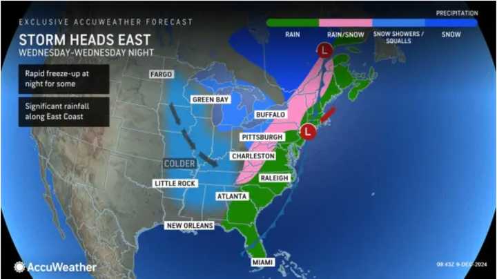
The National Weather Service says the storm will move from the southwest to the east on Tuesday night, Dec. 10, into Wednesday, Dec. 11. (See the first image above from AccuWeather.)
The storm, which will accompany a cold front, will bring widespread rainfall of 1 to 2 inches, with 2 to 4 inches in the areas indicated by the darker shade of green in the second image above.
During the storm's height, there will be heavy rain and wind gusts between 25 and 30 miles per hour.
"Wednesday is shaping up to be a very wet day up and down the I-95 corridor from northern Florida all the way to Maine," AccuWeather Senior Meteorologist Bill Deger said, noting that "both the morning and evening commutes in cities such as Washington, Baltimore, Philadelphia, New York, and Boston can be slowed by downpours, which can also cause localized flooding."
After the frontal system pushes through, it will be mostly sunny and colder on Thursday, Dec. 12.
Check back to Daily Voice for updates.
Click here to follow Daily Voice Cherry Hill and receive free news updates.

