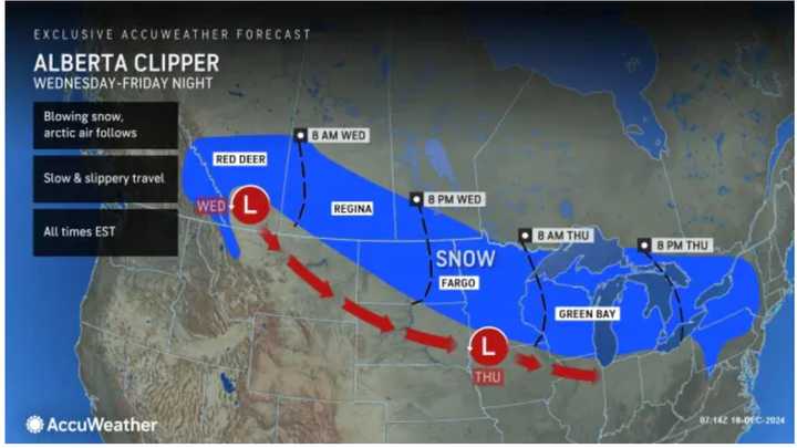
The merging of the two is expected late in the afternoon and into the evening on Friday, Dec. 20, the National Weather Service says.
Prior to that, there will be a chance for a mix of rain and slow in the morning.
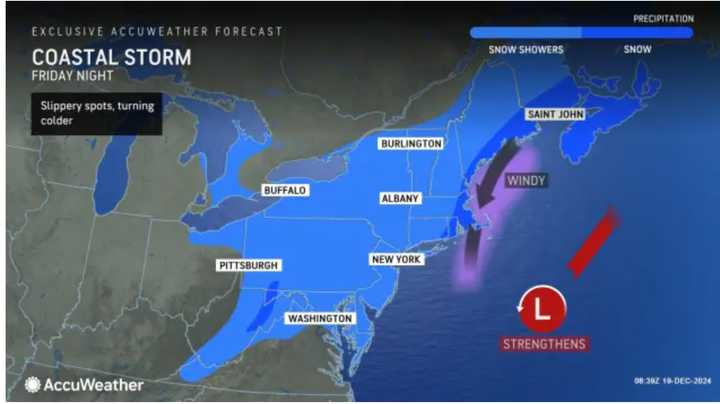
"As the clipper storm nears the Atlantic coast later Friday and Friday night, a transformation will take place," according to AccuWeather.
See the first image above, to see track of the Alberta Clipper system, and the second image to see the coastal system's path.
How quickly that the clipper's energy transfers to a budding coastal storm will have a detrimental impact on the intensity, duration and amount of snow that falls from the mid-Atlantic coast and central Appalachians through New England, said AccuWeather Senior Director of Forecasting Operations Dan DePodwin.
Click on the second image above to see the broad area in the path of the coast storm.
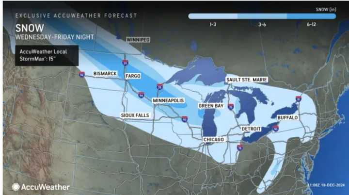
Areas farther south and east will see mainly rain or mixed precipitation at times. Click on the third image above to see the areas shown in the lightest shade of blue where a widespread 1 to 3 inches of snowfall is expected.
Wind gusts could be as high as 20 miles per hour Friday night and up to 25 mph on Saturday, Dec. 21 as much colder air arrives.
The storm will move out from south to the north overnight into Saturday morning, followed by mostly sunny skies the rest of the day on Saturday and again on Sunday, Dec. 22.
Overnight low temperatures both Saturday into Sunday and Sunday into Monday, Dec. 23 will be in the teens and 20s.
Monday will be sunny with the high temperature generally in the upper 20s.
Check back to Daily Voice for updates.
Click here to follow Daily Voice Belleville and receive free news updates.


