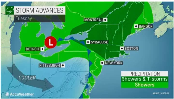
A few more strong to severe storms are possible along with heavy rainfall Tuesday, Sept. 13. (See the first image above from AccuWeather.com.)
Those storms could bring damaging wind gusts, and isolated tornadoes are possible, according to the National Weather Service.
"Locally heavy rain could cause minor flooding in urban, poor drainage and low-lying areas. Isolated flash flooding is possible," said the weather service.
There will be gradual clearing prior to the potential for more storm activity, which is most likely in the early afternoon Tuesday for most of the region.
Areas farther east could see storms as late as the early evening. For a look at where strong storms are most likely, click on the second image above.
The high temperature will be in the upper 70s to around 80 degrees Tuesday with high humidity.
After the front finally pushes through, skies will become mostly sunny on Wednesday, Sept. 14 with a high temperature around 80 degrees.
Thursday, Sept. 15 will also be pleasant with plenty of sunshine and a high temperature in the mid 80s.
Check back to Daily Voice for updates.
Click here to follow Daily Voice Yorktown and receive free news updates.


