The projected timing for the storm is from late Sunday night, Jan. 28 into around midday Monday, Jan. 29, according to the National Weather Service.
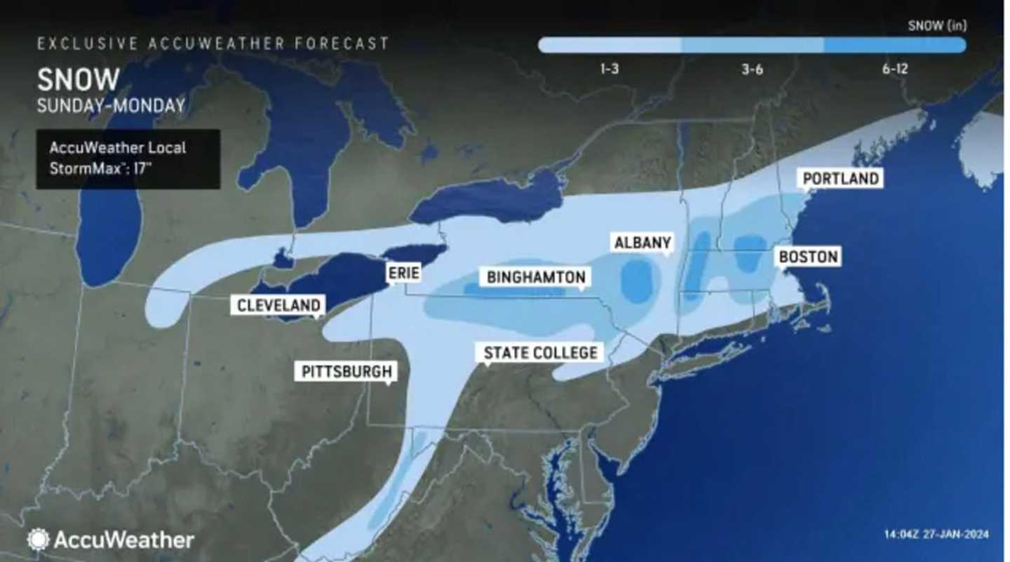
For the latest snowfall projections from AccuWeather.com released Saturday afternoon, Jan. 27, see the image above, with areas in the darkest shade of blue projected to see between 6 and 12 inches, 3 to 6 inches in the parts of the region shown in Columbia blue, and 1 to 3 inches in the areas in sky blue.
Areas farthest south, including New York City, Long Island, and much of coastal New England are expected to see a mix of snow, sleet, and rain.
Sunday, Jan. 28 will be raw with cooler temperatures and rain likely at times during the day and again at night when the storm will move in.
The high temperature Sunday will range from the upper 30s to around 40 degrees, before dipping below freezing overnight.
Monday's high temperature will hold steady at around the freezing mark to the mid-30s with mostly cloudy skies throughout the day.
It will be partly sunny and cold Tuesday, Jan. 30 with a high temperature in the mid-30s.
Check back to Daily Voice for updates.
Click here to follow Daily Voice Yorktown and receive free news updates.