
- Click here for an updated story: Nor'easter Nears: Winter Weather Advisory Issued For These Counties
The weekend will end with another cold day on Sunday, Nov. 17. The high temperature will be near 40 degrees, but it will feel colder, with the wind-chill factor in the 20s.
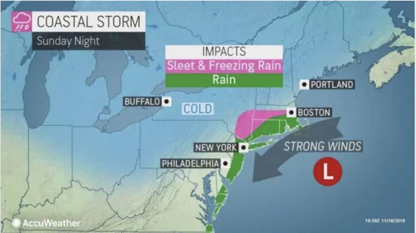
The potent storm arrives overnight at around 3 a.m. on Monday, Nov. 18. The low temperature will be right around the freezing mark for most of the region overnight, keeping the precipitation to rain. North of I-84, there will be a wintry mix and some patches of ice farthest north and on higher elevations in the morning. (See images above.)
Rain will continue through the early afternoon Monday. Though the high temperature will climb to the low to mid 40s, wind between 13 and 17 mph will make it feel like it's between 20 and 30 degrees.
Up to a half-inch of precipitation is possible.
Tuesday, Nov. 19 will become partly sunny with the high temperatures in the mid 40s after a chance of a mix of rain and snow early in the morning.
Check back to Daily Voice for updates.
Click here to follow Daily Voice Yonkers and receive free news updates.