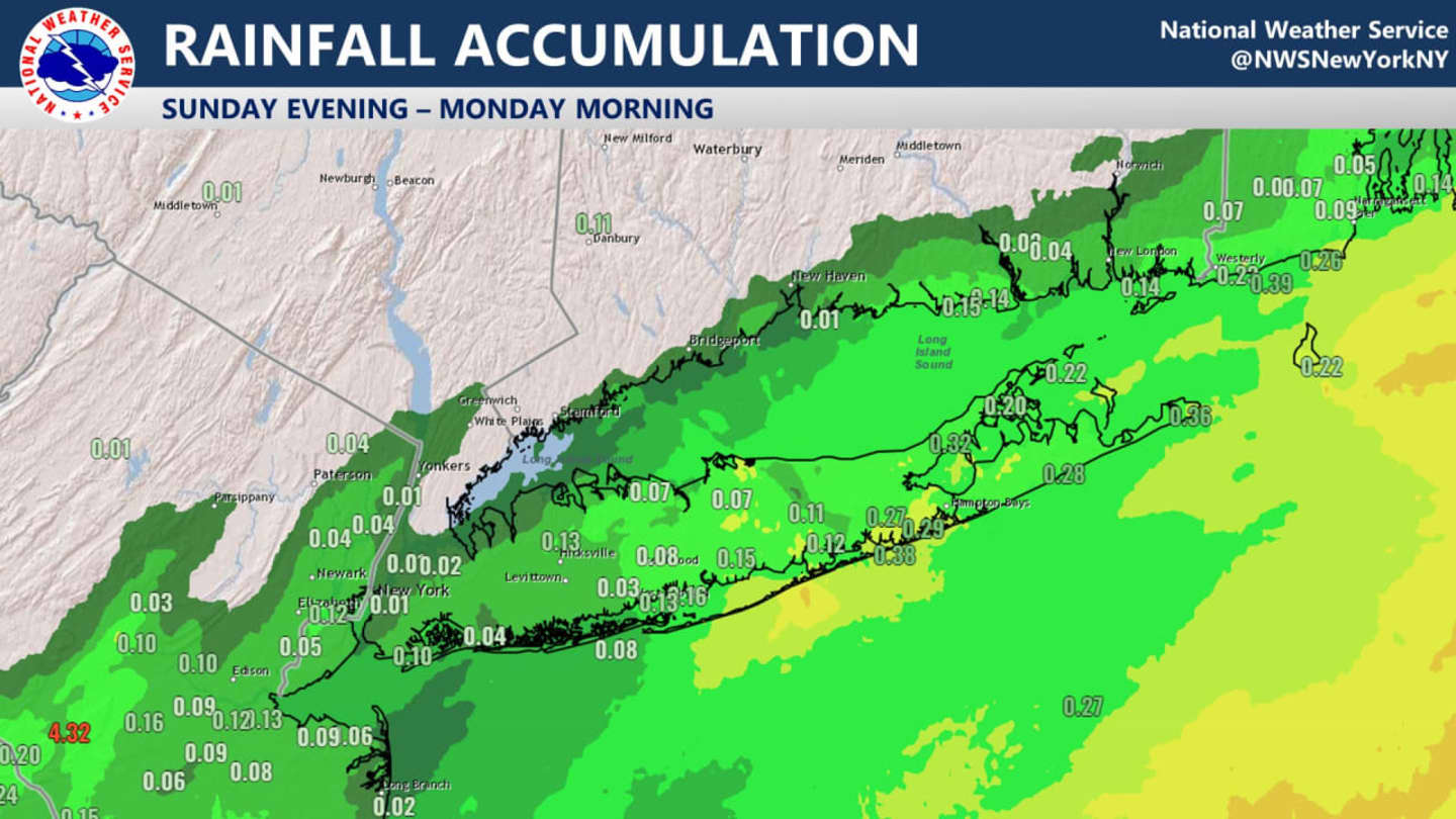
Some on the south shore and east end of Long Island saw more than a quarter of an inch of rainfall Sunday night, Feb. 12 into Monday morning, Feb. 13. (See the image above from the National Weather Service.)
Interior areas saw little or no precipitation from the system.
Skies will gradually clear on Monday morning, leading to a mostly sunny day with a high temperature in the low 50s.
Valentine's Day on Tuesday, Feb. 14 will be sunny and breezy with a high temperature of around 50 degrees and wind gusts up to 25 miles per hour.
Clouds will increase during the evening Tuesday, followed by a mostly cloudy start to the day on Wednesday, Feb. 15 before skies become mostly sunny, helping the temperature climb into the upper 50s.
An unsettled weather pattern will move in to end the workweek with showers likely on Thursday, Feb. 16, and spring-like temperatures all the way into the low 60s.
There will be more showers at times on Friday, Feb. 17 and a big drop in temperatures in the afternoon, going from a high daytime temperature in the upper 50s to an overnight low in the low 20s.
Check back to Daily Voice for updates.
Click here to follow Daily Voice White Plains and receive free news updates.