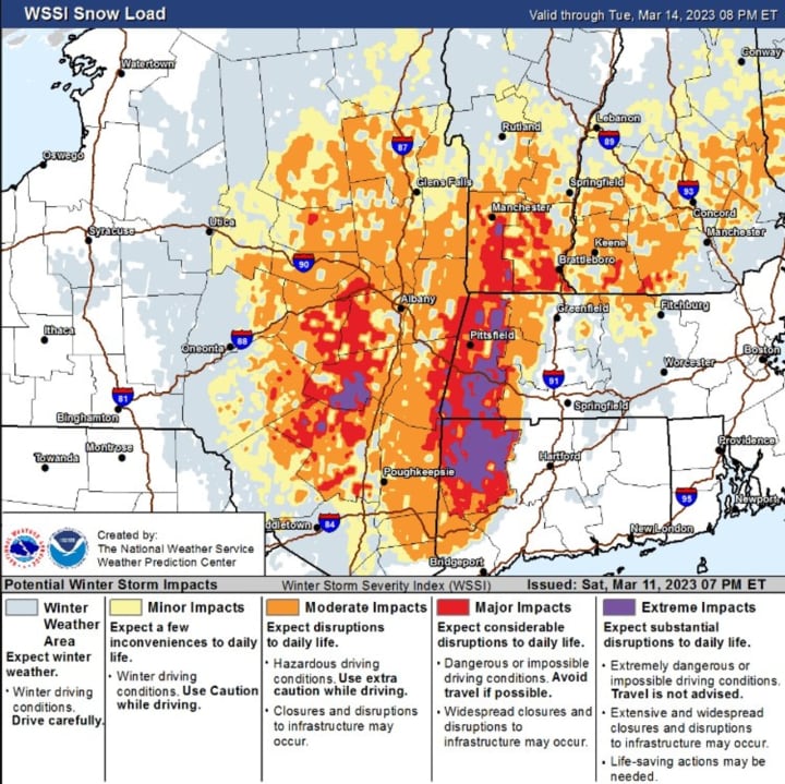
The time frame for the storm is Monday night, March 13 into early Wednesday morning, March 15, according to the National Weather Service.
Areas north of the I-84 corridor marked in purple in the first image above are expected to see extreme impacts, with major impacts in areas marked in red.
For the latest snowfall projections for the entire Northeast, see the second image above from AccuWeather.com.
Many areas north of the I-84 corridor should see 8 inches or more of accumulation, with the highest amounts of up to 18 inches. (See the second image above from the National Weather Service.)
Precipitation from the Nor'easter will arrive as rain and rain mixed with snow before a changeover to snow in much of the Northeast Monday night. Precipitation will then continue at times into just before daybreak on Wednesday.
Wind gusts will range from 40 to 70 miles per hour starting Monday night, March 13. (Click on the third image above.)
Areas most at risk for power outages due to fallen trees and power lines and gusty winds can be viewed by clicking on the fourth image above.
Wednesday, March 15 is expected to be mostly cloudy and breezy with a high temperature of around 40 degrees.
There's still some uncertainty surrounding the track, timing, and strength of the storm.
Check back to Daily Voice for updates.
Click here to follow Daily Voice White Plains and receive free news updates.


