

The time frame for storm activity on Monday, Aug. 22 is from the early morning hours through the evening, with up to 1 to 2 inches of much-needed rainfall possible, before another round of storms is expected on Tuesday, Aug.23.
Monday's high temperature will be around 80 degrees.
In addition to heavy rainfall at times on Monday, some of the storms could be accompanied by gusty winds.
"A nearly stationary front south of the area moves north as a warm front today, and become nearly stationary once again tonight," the National Weather Service said in a Hazardous Weather Statement issued early Monday morning. "At the same time, a slow-moving upper-level trough to our west will affect the area through tonight.
"There is the potential for heavy rainfall associated with showers and isolated thunderstorms this morning, and isolated flash flooding will be possible across the area."
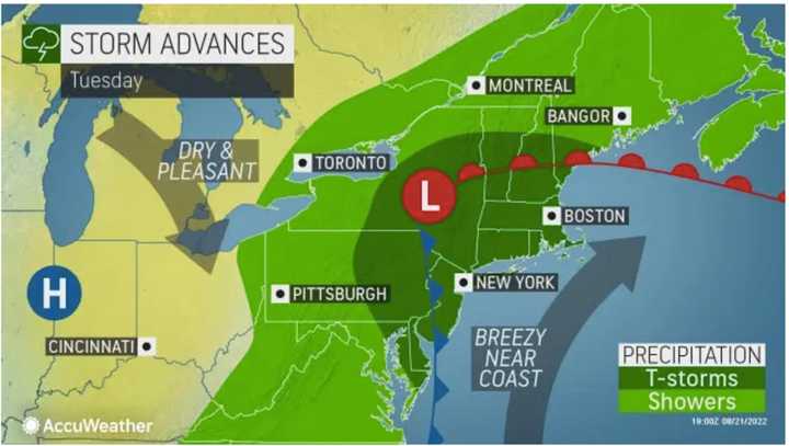
Areas where the strongest storms and steadiest rainfall are expected on Monday and Tuesday are shaded in dark green in the first and second images above from AccuWeather.com.
Tuesday will start off with a mix of clouds and sun, followed by a chance of showers and storms starting in the late morning. Tuesday's high temperature will be in the low to mid 80s.
Storms will then become likely in the afternoon into the middle of the evening Tuesday. About one-tenth of an inch of new rainfall is expected.
Skies will gradually clear overnight, leading to a partly cloudy day on Wednesday, Aug. 24 with a high temperature in the mid 80s and a slight chance of afternoon showers.
The unsettled stretch is expected to bring some relief from drought conditions.
Areas in which there are now severe and extreme drought conditions are shown in darker brown in the third image above.
Check back to Daily Voice for updates.
Click here to follow Daily Voice White Plains and receive free news updates.