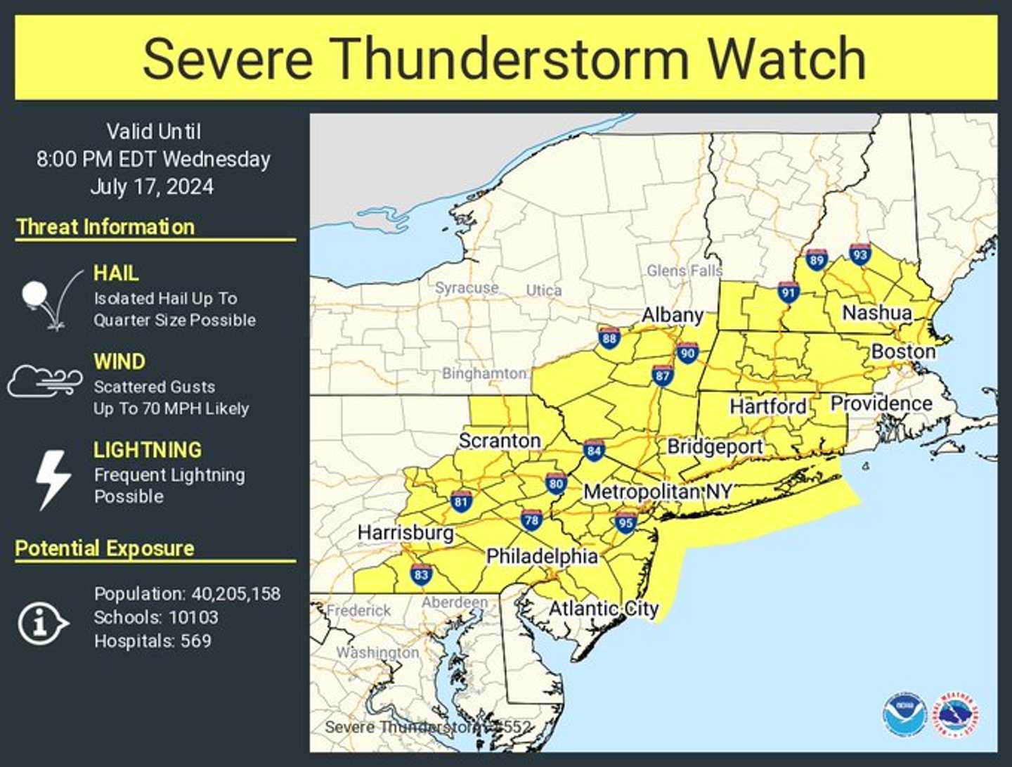

A Severe Thunderstorm Watch is in effect in areas shown in yellow in the first image above until 8 p.m. Wednesday, July 17.
Wind gusts could be as high as 70 mph in spots.
"Expect damage to trees and power lines," the National Weather Service said, noting that lightning will also pose a threat along with heavy rainfall and hail.
A radar image of the Northeast at 4:30 p.m. Wednesday shows severe storms marked in red.
Rainfall amounts of between 1 and 2 inches are expected from Wednesday afternoon into around daybreak on Thursday, July 18.
Wednesday will be hazy, hot, and humid during the day, with a high temperature in the low 90s.
After the cold front moves through, Thursday is expected to have less humid air and high temperatures in the mid-80s. Skies will gradually become mostly sunny during the day.
Friday, July 19, will be sunny with comfortable air and temperatures in the mid-70s.
It will be a bit warmer on Saturday, July 20, with high temperatures on either side of 90 degrees.
The outlook for Sunday, July 21, calls for mostly sunny skies with a high again around 90.
Check back to Daily Voice for updates.
Click here to follow Daily Voice White Plains and receive free news updates.