Tuesday, Oct. 31 has started off with patchy morning fog and brisk conditions. The high temperature will be only in the upper 40s under mainly sunny skies, according to the National Weather Service.
The chance for snow will come overnight Tuesday into Wednesday, Nov. 1 as the coldest air of the season arrives, with temperatures dropping to around the 30-degree mark in some spots.
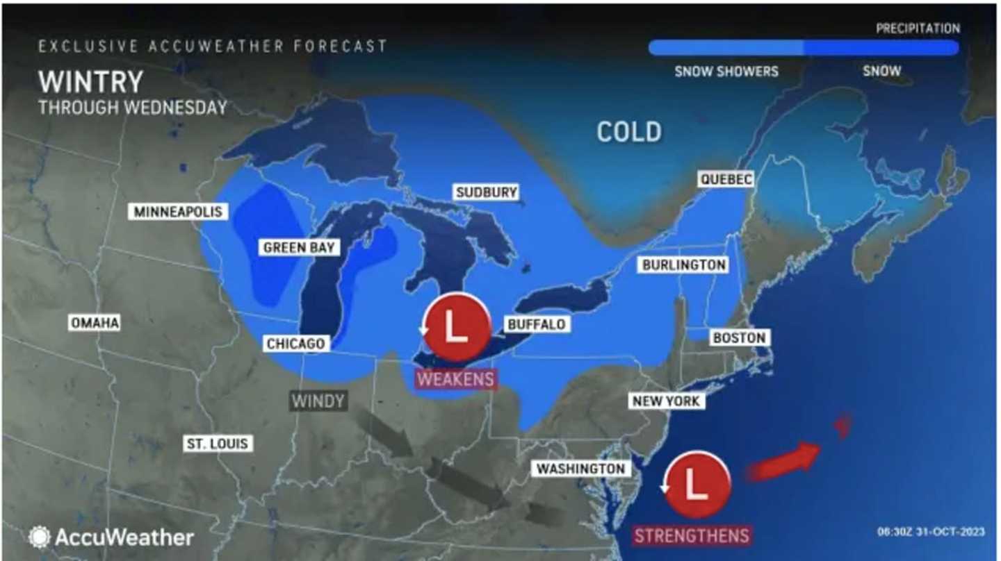
Areas in blue in the image above from AccuWeather.com could see snow showers.
The overall temperature drop from highs during the springlike surge in temperatures late last week may be close to 50 degrees in some spots.
"High temperatures can be more than 30 degrees lower than last week across a wide swath of the Northeast," according to AccuWeather Meteorologist Brandon Buckingham.
Wednesday will be mostly cloudy and cool with a high temperature in the mid-40s, the National Weather Service says, noting that there could be a passing shower.
More patchy frost is expected overnight into Thursday morning, Nov. 2 will be mostly sunny with a high temperature in the upper 40s.
Friday, Nov. 3 will mark the start of a stretch of climbing temperatures with a high in the low to mid-50s.
Saturday, Nov. 4 will be partly sunny with a high in the upper 50s before it's time to fall back overnight when we set our clocks back an hour on Sunday, Nov. 5 at 2 a.m. for Daylight Standard Time.
Check back to Daily Voice for updates.
Click here to follow Daily Voice White Plains and receive free news updates.