According to the National Weather Service, investigations are underway in parts of upstate New York and northern New England after possible tornadic activity occurred during a storm system on Wednesday, July 10, fueled by the remnants of Beryl.
Thursday, July 11 will become partly to mostly sunny after a cloudy start to the day with lingering showers pushing east. The high temperature will be in the upper 80s.
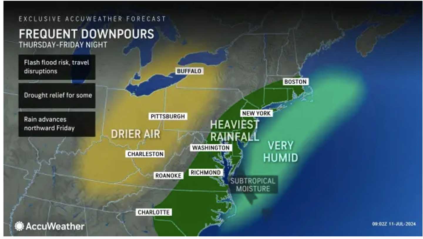
It should be mainly dry during the day before the chance for overnight showers and thunderstorms.
After a partly sunny start on Friday, July 12, showers will likely occur in the afternoon, and thunderstorms are possible from the early afternoon through the evening.
Some storms will bring heavy rain and gusty winds, and generally, about an inch of rainfall is expected.
Temperatures will top out in the mid-80s on Friday.
Saturday, July 13, will be mostly cloudy. A new round of showers and storms is likely between mid-afternoon and early evening, and another half-inch or so of rain is expected.
Temperatures will again be in the mid-80s.
It will be warm but dry for the second half of the weekend with sunny skies on Sunday, July 14, and less humidity. The high will be in the low 90s.
The outlook for Monday, July 15 calls for mostly sunny skies and a high temperature in the low 90s.
Check back to Daily Voice for updates.
Click here to follow Daily Voice Middletown-Wallkill and receive free news updates.