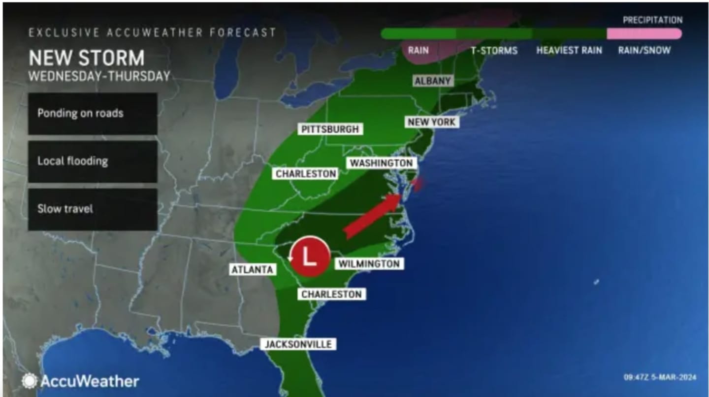
The heaviest rain from that system is expected to come Wednesday night, March 6.
Tuesday, March 5 has started with patchy fog. It will be cloudy and breezy the rest of the day with periods of rain.
About a half-inch to three-quarters of an inch of rainfall is possible and wind gusts could reach 20 miles per hour.
Tuesday's high temperature will be in the mid-40s to around 50 degrees.
The more potent system will arrive on Wednesday afternoon.
Rain will be heavy at times Wednesday night, and overnight into Thursday, March 7.
A total of up to 2 inches of rainfall is expected from that system alone.
"The potential exists for mainly localized impacts from flash flooding," the National Weather Service said, noting excessive rainfall is possible in spots.
Wednesday's high temperature will be in the mid-50s, and Thursday's high in the mid-40s to around 50 degrees.
It will remain cloudy Thursday afternoon and evening after the storm winds down, but there could be scattered rain and showers at times.
There will be a reprieve from the stretch of gray days on Friday, March 8, which will be mostly sunny with a high of around 50.
The weekend will be marked by a drop in temps, which will lead to a snow chance.
The high temperature on Saturday, March 9 will be in the low to mid-40s with mostly cloudy skies and a chance for rain or showers.
Rain is likely on Saturday night into Sunday, March 10 as Daylight Saving time begins at 2 a.m. Sunday, when clocks "Spring forward" an hour.
Sunday will be a raw day with high temperatures ranging from the upper 30s to low 40s.
With precipitation expected to continue overnight, there is a chance of snow, especially inland, in areas where the temperature is expected to be at or below the freezing mark.
The system is now expected to move out by daybreak on Monday, March 11, leading to a partly sunny and breezy day with a high temperature mainly in the low 40s.
Check back to Daily Voice for updates.
Click here to follow Daily Voice Ulster Sullivan and receive free news updates.