Tag:

Severe Thunderstorm Watch

Severe Thunderstorm Watch Issued For Part Of Long Island Severe Thunderstorm Watch Issued For Part Of Long Island
Severe Thunderstorm Watch Issued For Part Of Long Island With a new round of storms moving from west to east, a Severe Thunderstorm Watch has been issued for much of the region. The watch is in effect until 11 p.m. Friday, Sept. 8 for southeastern New York and areas in western as well as coastal Connecticut.  Potentially damaging wind gusts are the primary threat, with potentially damaging hail also possible, according to the National Weather Service. Localized heavy rainfall and lightning are also possible. In New York, the following counties are covered by the watch: New York City: Bronx, Kings (Brooklyn), New York (Manhattan…
Severe Thunderstorm Watch In Effect For Much Of Eastern NY Severe Thunderstorm Watch In Effect For Much Of Eastern NY
Severe Thunderstorm Watch In Effect For Much Of Eastern NY With a round of storms moving from west to east in interior portions of the region, a Severe Thunderstorm Watch has been issued for much of the area The watch is in effect until 9 p.m. Thursday, Sept. 7.  Potentially dangerous straight-line wind gusts are the primary threat, with potentially damaging hail also possible, according to the National Weather Service. Localized heavy rainfall and lightning are also possible. In New York, the following counties are covered by the watch: Dutchess Rockland Orange Ulster Sullivan Columbia Greene Albany Rensselaer Schenectady Saratoga Sc…
Severe Thunderstorm Watch Now In Effect For Much Of Long Island Severe Thunderstorm Watch Now In Effect For Much Of Long Island
Severe Thunderstorm Watch Now In Effect For Much Of Long Island As a potent system with scattered severe storms sweeps through, a Severe Thunderstorm Watch has now been issued for much of the region. It's in effect until midnight Sunday, Aug. 13. The main threat is for damaging wind gusts and large hail, the National Weather Service said, adding that isolated tornadoes are possible, mainly north and west of New York City. In addition, storms will be capable of locally heavy rainfall which could lead to some urban, low lying and poor drainage flooding with isolated to scattered flash flooding possible. In New York, the watch co…
Severe Thunderstorm Watch Issued For Suffolk County, With Damaging Winds, Tornadoes Possible Severe Thunderstorm Watch Issued For Suffolk County, With Damaging Winds, Tornadoes Possible
Severe Thunderstorm Watch Issued For Suffolk County, With Damaging Winds, Tornadoes Possible A Severe Thunderstorm Watch has been issued for most of the region as a potent system develops that will bring drenching downpours, and damaging wind gusts between 60 and 70 miles per hour with 1-inch hail and an isolated tornado. The watch was issued just before 3 p.m. Saturday, July 29, and is in effect until 9 p.m. Saturday. In New York, the watch covers the following counties: All of New York City Nassau Suffolk Westchester Putnam Rockland Orange Dutchess Ulster Sullivan Columbia Greene Albany Rensselaer Schenectady Schoharie Broome  Chenango Delaware Montgomery OtsegoI…
Severe Thunderstorm Watch In Effect For Much Of NY Severe Thunderstorm Watch In Effect For Much Of NY
Severe Thunderstorm Watch In Effect For Much Of NY With a new round of storms developing, a Severe Thunderstorm Watch has been issued for much of the Northeast. In New York, the following counties: Westchester Putnam Dutchess Rockland Orange Ulster Sullivan Albany Columbia Greene Rensselaer Schoharie The watch covers all eight counties in Connecticut and the following counties in Massachusetts: Berkshire Bristol Essex Franklin Hampden Hampshire Middlesex Norfolk Plymouth Suffolk Worcester The watch was issued at 12:45 p.m. Thursday, July 27, by the National Weather Service and is in effect until 8 p.m. Thursday. Some of the storms could…
Strong Storms With Heavy Rain, Gusty Winds Taking Aim At Region: Here's What's Coming Strong Storms With Heavy Rain, Gusty Winds Taking Aim At Region: Here's What's Coming
Strong Storms With Heavy Rain, Gusty Winds Taking Aim At Region: Here's What's Coming New update: Severe Thunderstorm Watch In Effect For Much Of Region A new storm system accompanied by locally heavy rain, gusty winds, frequent lightning, and possible flash flooding will sweep through the region before things heat up for the rest of the week. Storm activity on Tuesday, July 25, will start from west to east in the early afternoon and continue through the evening, according to the National Weather Service. "Due to the copious amounts of moisture in the atmosphere and weak steering winds, any shower or thunderstorm has the potential to produce localized flooding dow…
Severe Thunderstorm Watch In Effect For Much Of Region Severe Thunderstorm Watch In Effect For Much Of Region
Severe Thunderstorm Watch In Effect For Much Of Region With a new round of storms heading eastward, a Severe Thunderstorm Watch has been issued for much of the region. It covers all eight counties in Connecticut, and in New York, the following counties: Westchester Putnam Dutchess Columbia Rensselaer Washington The watch was issued at 1 p.m. Friday, July 21, and is in effect until 8 p.m. Friday. Some of the storms could produce gusty winds and heavy rain.  "Locally heavy downpours may produce isolated to scattered areas of flash flooding," the National Weather Service said. The first round of showers and storms moved through …
Severe Thunderstorm Watch Issued With 58 MPH Wind Gusts, Hail, Isolated Tornadoes Possible Severe Thunderstorm Watch Issued With 58 MPH Wind Gusts, Hail, Isolated Tornadoes Possible
Severe Thunderstorm Watch Issued With 58 MPH Wind Gusts, Hail, Isolated Tornadoes Possible A Severe Thunderstorm Watch is now in effect for the region as a band of storms moves from the west to the east. The watch went into effect at 5:15 p.m. Saturday, April 1, and lasts until 10 p.m. Saturday, the National Weather Service announced. New York counties covered by the watch are: Albany Bronx  Columbia  Dutchess  Fulton  Greene Herkimer Kings (Brooklyn) Montgomery Nassau New York (Manhattan) Orange Putnam Queens Rensselaer Richmond (Staten Island) Rockland Saratoga Schenectady Schoharie Suffolk Ulster Westchester Connecticut counties covered by the watch are: …
Severe Thunderstorm Watch Issued With 60 MPH Wind Gusts, Hail, Isolated Tornadoes Possible Severe Thunderstorm Watch Issued With 60 MPH Wind Gusts, Hail, Isolated Tornadoes Possible
Severe Thunderstorm Watch Issued With 60 MPH Wind Gusts, Hail, Isolated Tornadoes Possible A Severe Thunderstorm Watch is now in effect for much of the region as scattered to numerous showers and storms are expanding. The watch does not currently include Long Island or New York City but covers much of downstate New York, as well as New England. 
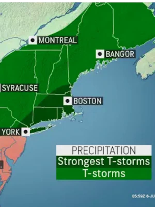
The watch was issued at 1:05 p.m. Friday, Aug. 26, and will remain in effect until 8 p.m. Friday. A few storms may be strong or severe, with damaging winds gusts of as high as around 60 miles per hour, torrential downpours, and lightning, with 1-inch hail and isolated tornadoes possible. "If you can hear thunder, you're close enough…
Severe Thunderstorm Watch Issued With 65 MPH Wind Gusts, Hail, Isolated Tornadoes Possible Severe Thunderstorm Watch Issued With 65 MPH Wind Gusts, Hail, Isolated Tornadoes Possible
Severe Thunderstorm Watch Issued With 65 MPH Wind Gusts, Hail, Isolated Tornadoes Possible A Severe Thunderstorm Watch is now in effect for the region as rounds of storms are expected to roll through with damaging winds, quarter-size hail, frequent lightning, and isolated tornadoes possible. The watch went into effect Monday, July 25 at 1:05 p.m. and lasts until 8 p.m. Doppler radar and automated rain gauges indicated thunderstorms producing heavy rain across the area beginning at around 1 p.m., the National Weather Service said. "The expected rainfall rate is 1 to 2 inches in one hour," the weather service said. "Additional rainfall amounts of 1 to 2 inches, loca…
Severe Thunderstorm Watch Issued For Parts Of Long Island, 60 MPH Winds Possible Severe Thunderstorm Watch Issued For Parts Of Long Island, 60 MPH Winds Possible
Severe Thunderstorm Watch Issued For Parts Of Long Island, 60 MPH Winds Possible A Severe Thunderstorm Watch is now in effect for much of the region, including parts of Long Island, as a new round of storms is expected to roll through with damaging winds and isolated tornadoes possible. The watch went into effect Thursday, July 21 at 1:15 p.m. and lasts until 8 p.m. It currently covers Nassau County, but has not been issued for Suffolk County. At 1:17 p.m., a severe thunderstorm was located over the Bronx, moving east at 30 miles per hour, the National Weather Service said. Golf ball-size hail and 60 mph wind gusts are possible, along with up to ping-pong ball-siz…
Quick-Moving Gusty Storms Cause Numerous Power Outages On Long Island Quick-Moving Gusty Storms Cause Numerous Power Outages On Long Island
Quick-Moving Gusty Storms Cause Numerous Power Outages On Long Island A quick-moving line of thunderstorms with strong gusty winds moving from west to east has resulted in numerous power outages on Long Island. As of around 4:15 p.m. Saturday, Nov. 13, PSEG Long Island is reporting 7,139 customers without power. Storm radar shows most of the severe storms have moved east, but a Severe Thunderstorm Watch remains in effect for all of Long Island until 7 p.m. Saturday. Related story: Severe Thunderstorm Watch Now In Effect For Much Of Region Check back to Daily Voice for updates.
Severe Thunderstorm Watch In Effect For Much Of Long Island Severe Thunderstorm Watch In Effect For Much Of Long Island
Severe Thunderstorm Watch In Effect For Much Of Long Island A Severe Thunderstorm Watch has been issued for a large portion of the Northeast. It's in effect until 11 p.m. Saturday, July 17. Damaging wind gusts in excess of 60 miles per hour are the main threat with any thunderstorm that becomes severe, the National Weather Service said in issuing the watch. Torrential downpours, frequent lightning, and flash flooding are all possible, along with quarter-size hail. A Flash Flood Watch remains in effect until Sunday morning, July 18. Earlier report: Severe Storms Expected With 70 MPH Wind Gusts, Drenching Downpours, Possible Tornadoes Fo…
Severe Storms Expected With 70 MPH Wind Gusts, Drenching Downpours, Possible Tornadoes Severe Storms Expected With 70 MPH Wind Gusts, Drenching Downpours, Possible Tornadoes
Severe Storms Expected With 70 MPH Wind Gusts, Drenching Downpours, Possible Tornadoes Click here for an updated story: Severe Thunderstorm Watch In Effect, With 60 MPH-Plus Wind Gusts Expected, Tornadoes Possible A new round of severe thunderstorms is expected to sweep through the region. The time frame for storm activity is from mid-afternoon, Saturday, July 17. through late Saturday night. The primary threat is damaging wind gusts, the National Weather Service said in a Hazardous Weather Statement issued Saturday morning. Wind gusts up to 70 miles per hour are possible. Drenching downpours are expected. Isolated tornadoes are possible. (See the first image above.) …
Severe Thunderstorm Watch In Effect For Entire Region, With Damaging Wind Gusts Possible Severe Thunderstorm Watch In Effect For Entire Region, With Damaging Wind Gusts Possible
Severe Thunderstorm Watch In Effect For Entire Region, With Damaging Wind Gusts Possible A Severe Thunderstorm Watch is now in effect for the entire region. Damaging winds with gusts that could cause power outings are the main threat, the National Weather Service said in issuing the alert. Flash flooding, frequent lightning and large hail are possible. It lasts until 11 p.m. Wednesday, July 7, for these areas: Long Island,  Westchester, Putnam, Rockland, Putnam, Dutchess, Orange, and Ulster counties in the Hudson  Valley,  All of New York City, Fairfield, Hartford, Litchfield, New Haven, New London, Middlesex, Tolland, and New London counties in Connecticut. Al…
Severe Thunderstorm Watch In Effect For Entire Region, With 65 MPH Wind Gusts Possible Severe Thunderstorm Watch In Effect For Entire Region, With 65 MPH Wind Gusts Possible
Severe Thunderstorm Watch In Effect For Entire Region, With 65 MPH Wind Gusts Possible A Severe Thunderstorm Watch is now in effect for the entire region. Damaging winds with gusts of 65 miles per hour that could cause power outings are the main threat, the National Weather Service said in issuing the alert. Frequent lightning and large hail are possible. It lasts until 10 p.m. Tuesday, July 6, for these areas: Long Island,  Westchester, Rockland, Putnam, and Orange counties  The Bronx, Brooklyn, Queens, and Staten Island,  Fairfield, New Haven, Middlesex, and New London counties in Connecticut.  It last until 8 p.m. Tuesday, July 6, for these areas: A…
Severe Thunderstorm Watch In Effect For Part Of Long Island Severe Thunderstorm Watch In Effect For Part Of Long Island
Severe Thunderstorm Watch In Effect For Part Of Long Island With a line of potent storms moving from west to east late in the afternoon on Friday, June 4, a Severe Thunderstorm Watch is now in effect for much of the region. It was issued at 3:05 p.m. and lasts until 8 p.m. Friday. It includes New York City as well as much of New Jersey, western Long Island as well as Westchester, Rockland, and Fairfield counties. (See image above.) Heavy rain, scattered wind gusts up to 60 to 65 miles per hour, hail up to 1 inch in diameter and frequent lightning are possible, according to the National Weather Service. Check back to Daily Voice for updates.
Line Of Severe Thunderstorms Moving Through Region With Damaging Wind Gusts, Tornadoes Possible Line Of Severe Thunderstorms Moving Through Region With Damaging Wind Gusts, Tornadoes Possible
Line Of Severe Thunderstorms Moving Through Region With Damaging Wind Gusts, Tornadoes Possible A line of severe storms is moving through the region with a Severe Thunderstorm Watch in effect for much of the Northeast. It lasts until late in the evening on Wednesday, May 26. "An approaching cold front will bring potential for scattered strong to severe thunderstorms this afternoon into this evening," the National Weather Service said in a statement accompanying the alert. "Strong to damaging wind gusts will be the main threat. Hail and even an isolated tornado is also a possibility." Torrential rainfall is possible during storm activity. It will remain warm Thursday, …
Severe Thunderstorm Watch Issued; Damaging Winds, Lightning Expected, Hail, Tornadoes Possible Severe Thunderstorm Watch Issued; Damaging Winds, Lightning Expected, Hail, Tornadoes Possible
Severe Thunderstorm Watch Issued; Damaging Winds, Lightning Expected, Hail, Tornadoes Possible With a line of potentially strong storms moving toward the region, the National Weather Service has issued a Severe Thunderstorm Watch for the entire region. It's in effect until 6 p.m. Wednesday, April 21. It was issued at 12:30 p.m. The storms will bring damaging wind gusts, the weather service said. Lightning is also expected and hail is possible. In addition, isolated tornadoes cannot be ruled out. "The collision with the warm air lingering along the East Coast early on Wednesday and the fresh push of cold Arctic air, will help create an unstable enough environment for thunderstorms on…
Severe Thunderstorm Watch Now In Effect For Parts Of Region Severe Thunderstorm Watch Now In Effect For Parts Of Region
Severe Thunderstorm Watch Now In Effect For Parts Of Region A Severe Thunderstorm Watch is now in effect for parts of the region and may be expanded as several lines of storms, currently mainly north of I-84, are moving from west to east. Currently, the watch is in effect for Dutchess and Ulster counties in the Hudson Valley, Litchfield and Hartford counties in Connecticut, and Hampden, Hampshire and Worcester counties in Massachusetts. That watch was issued on Saturday, Aug. 29 at 7:10 p.m. It will last through midnight Sunday, Aug. 30. The main threat will be damaging winds. Check back to Daily Voice for updates.
Severe Thunderstorm Watch Now In Effect For Region Severe Thunderstorm Watch Now In Effect For Region
Severe Thunderstorm Watch Now In Effect For Region A Severe Thunderstorm Watch is in now in effect for the entire region. The watch was issued on Tuesday, Aug. 25 at 3:10 p.m. It will last through 10 p.m. Tuesday. At 3:30 p.m., several lines of storms were moving from west to east. The main threat will be damaging winds, with gusts up to 70 miles per hour possible, the National Weather Service said. Isolated hail up to ping-pong size, downpours and frequent lightning are also possible. Earlier report - Severe Weather Alert: Storms With Damaging Winds, Heavy Rain, Possible Hail Will Sweep Through
Severe Thunderstorm Watch Issued For Area Severe Thunderstorm Watch Issued For Area
Severe Thunderstorm Watch Issued For Area The National Weather Service has issued a Severe Thunderstorm Watch for the region. It lasts through 10 p.m. Thursday, July 23. Showers and thunderstorms are starting to pop up across the area and are moving west to east.  Some of these storms could be strong to severe with damaging winds as well as one-inch hail, frequent lightning, and heavy rainfall. Scattered power outages are possible. Check back to Daily Voice for updates. Earlier report - Severe Weather Alert: New Round Of Strong Thunderstorms With Damaging Winds Expected
Severe Thunderstorm Watch Issued With Damaging 70 MPH Wind Gusts Possible Severe Thunderstorm Watch Issued With Damaging 70 MPH Wind Gusts Possible
Severe Thunderstorm Watch Issued With Damaging 70 MPH Wind Gusts Possible A Severe Thunderstorm Watch has been issued for the entire region by the National Weather Service. The watch is in effect until 10 p.m. Wednesday, July 22 for the areas in yellow in the image above. Damaging winds with gusts up to 70 miles per hour that could cause power outages are the main threat. Lightning, large hail and heavy downpours are all possible.  Isolated tornadoes cannot be ruled out. The time frame for the storms is from about 4 p.m. to 10 p.m. Wednesday. Earlier report - Severe Weather Alert: Storms With Strong Winds Will Sweep Through; Hail, Tornadoes Possible Che…
Severe Thunderstorm Watch Issued For Entire Region Severe Thunderstorm Watch Issued For Entire Region
Severe Thunderstorm Watch Issued For Entire Region The National Weather Service has issued a Severe Thunderstorm Watch for the entire region. It was issued at 1:29 p.m. Sunday, June 28 and is in effect until 8 p.m. Sunday. Showers and thunderstorms are starting to pop up across the area and are moving west to east.  Some of these storms could be strong to severe with damaging winds as well as hail, frequent lightning, and heavy rainfall, the National Weather Service said. Scattered power outages are possible. Check back to Daily Voice for updates. Earlier report: More Strong Thunderstorms Expected, With Damaging Winds,…
Severe Thunderstorms Sweeping Through Region: Here's Latest Severe Thunderstorms Sweeping Through Region: Here's Latest
Severe Thunderstorms Sweeping Through Region: Here's Latest A round of scattered severe thunderstorms with damaging winds that could cause power outages is sweeping through the area. At 7:30 p.m. Friday, May 29, radar indicated strong storms were located north of New York City, along a line extending from six miles northeast of Hopewell Junction in Dutchess County to Yorktown Heights in Northern Westchester. (See first image above.) Expect multiple lines/rounds of storms, the National Weather Service said, noting that heavy downpours could cause flooding, especially in low-lying areas with poor drainage.  The strong wind gusts could …
Severe Storms, Strong Wind Gusts Pounding Area: Here's Latest Info Severe Storms, Strong Wind Gusts Pounding Area: Here's Latest Info
Severe Storms, Strong Wind Gusts Pounding Area: Here's Latest Info Severe thunderstorms and strong winds are making for a stormy Halloween night. On Long Island, nearly 3,000 power outages have been reported at 8 p.m. on Thursday, Oct. 31. A Severe Thunderstorm Watch was issued at 7:54 p.m. lasting through 1 a.m. Friday, Nov. 1 for Westchester, Putnam, Rockland and Orange counties. Strong winds are bringing down scattered limbs, trees, and power lines. More power outages are expected. A wind advisory for Coastal Fairfield, Nassau County and southern Suffolk County is in effect through 6 a.m. Friday, Nov. 1. Wind gusts up to 50 miles per hour a…
Severe Thunderstorm Watch Issued For Area; Damaging Winds, Hail, Tornadoes Possible Severe Thunderstorm Watch Issued For Area; Damaging Winds, Hail, Tornadoes Possible
Severe Thunderstorm Watch Issued For Area; Damaging Winds, Hail, Tornadoes Possible A Severe Thunderstorm Watch has been issued for the entire region with storms now likely during the afternoon and evening on Wednesday, Sept. 4. The main threat will be strong, damaging winds and hail, the National Weather Service said. A couple of tornadoes are also possible. (See first image above.) The watch went into effect just before 1 p.m. Wednesday and lasts until 9 p.m. Wednesday. After a pleasant day on Thursday, Sept. 5 with sunny skies and a high temperature in the upper 70s, the New York metropolitan area is in the range for Tropical Storm-force winds from Dorian on Frida…
Severe Thunderstorm Watch Now In Effect: Strong Storms With Gusty Winds Sweeping Through Area Severe Thunderstorm Watch Now In Effect: Strong Storms With Gusty Winds Sweeping Through Area
Severe Thunderstorm Watch Now In Effect: Strong Storms With Gusty Winds Sweeping Through Area With rounds of strong thunderstorms now sweeping through, a Severe Thunderstorm Watch is now in effect until 9 p.m. Wednesday, Aug. 21 for the entire area.  Be on the lookout for rapidly changing weather conditions into the evening, the National Weather Service said. The chance for storm activity will continue for several hours after the watch ends, until 1 a.m. Thursday, Aug. 22. During that time, more than an inch of rainfall is likely, with locally higher amounts. The main threat will be damaging winds with gusts up to 70 miles per hour possible that could bring down trees, …
Severe Thunderstorm Watch Now In Effect: Drenching Rain, Damaging Winds On Way Severe Thunderstorm Watch Now In Effect: Drenching Rain, Damaging Winds On Way
Severe Thunderstorm Watch Now In Effect: Drenching Rain, Damaging Winds On Way With gusty storms packing damaging winds and drenching rain closing in on the area, a Severe Thunderstorm Watch is now in effect. Thunder, frequent lightning and local flash flooding are also expected, with large hail possible. The watch is in effect for the entire region until 9 p.m. Wednesday, Aug. 7. A half-inch of rainfall is possible during the afternoon and evening on Wednesday. Look for storm activity to wrap up by around 11 p.m. Wednesday. Thursday, Aug. 8 will be partly sunny with a high temperature in the mid 80s. There's a 30-percent chance for more storms Thursday, mai…
Severe Weather Alert: Strong Storms Will Bring Drenching Rain, Damaging Winds Severe Weather Alert: Strong Storms Will Bring Drenching Rain, Damaging Winds
Severe Weather Alert: Strong Storms Will Bring Drenching Rain, Damaging Winds Click here for an updated story: Severe Thunderstorm Watch Now In Effect: Drenching Rain, Damaging Winds On Way Severe, gusty storms with damaging winds and drenching rain will roll through the area. Thunder, frequent lightning and local flash flooding are also expected, with large hail possible. Isolated storm activity will begin around 2 p.m. Wednesday, Aug. 7 on a mostly cloudy day in which the high temperature will be in the mid 80s.  Storms will become more widespread in the late afternoon and through the evening, the National Weather Service said in a Hazardous Weather St…
Severe Thunderstorm Watch Now In Effect: Wind Gusts Up To 70 MPH; Hail, Flooding Possible Severe Thunderstorm Watch Now In Effect: Wind Gusts Up To 70 MPH; Hail, Flooding Possible
Severe Thunderstorm Watch Now In Effect: Wind Gusts Up To 70 MPH; Hail, Flooding Possible A Severe Thunderstorm Watch is now in effect for the tristate area. The watch, issued just before 1:30 p.m. on Wednesday, July 31, is in effect until 9 p.m. The watch covers New York City, Long Island, Westchester, Putnam, Rockland, Orange and Fairfield counties. Showers and thunderstorms that will bring drenching downpours, thunder, frequent lightning and damaging wind gusts to the region are likely Wednesday afternoon and evening. Localized flash flooding and hail are also possible, the National Weather Service said in a Hazardous Weather Statement. Strong wind gusts of up to …