
The massive system arrived on Sunday afternoon, Dec. 10, and will continue into Monday, Dec. 11.
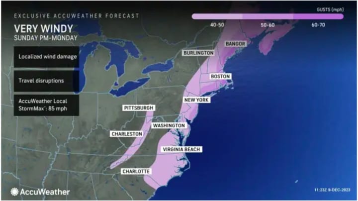
Sustained south-southeast winds of 25 to 40 miles per hour with gusts of 45 to 55 miles per hour are expected through Monday morning, with stronger gusts up to 60 miles per hour farther east, and up to 70 mph along the New England coast, according to the National Weather Service.
"At their peak, winds could gust to 50-60 mph in Boston and New York City, with higher gusts of 60-70 possible on Long Island and along the southern coast of Massachusetts, including Cape Cod, Nantucket and Martha's Vineyard," according to the National Weather Service. "Damage or blow away of poorly secured outdoor objects is expected."
Numerous tree limbs and scattered trees and power lines could be downed, the weather service noted, adding, "Expect poorly secured outdoor objects to be damaged or blown away."
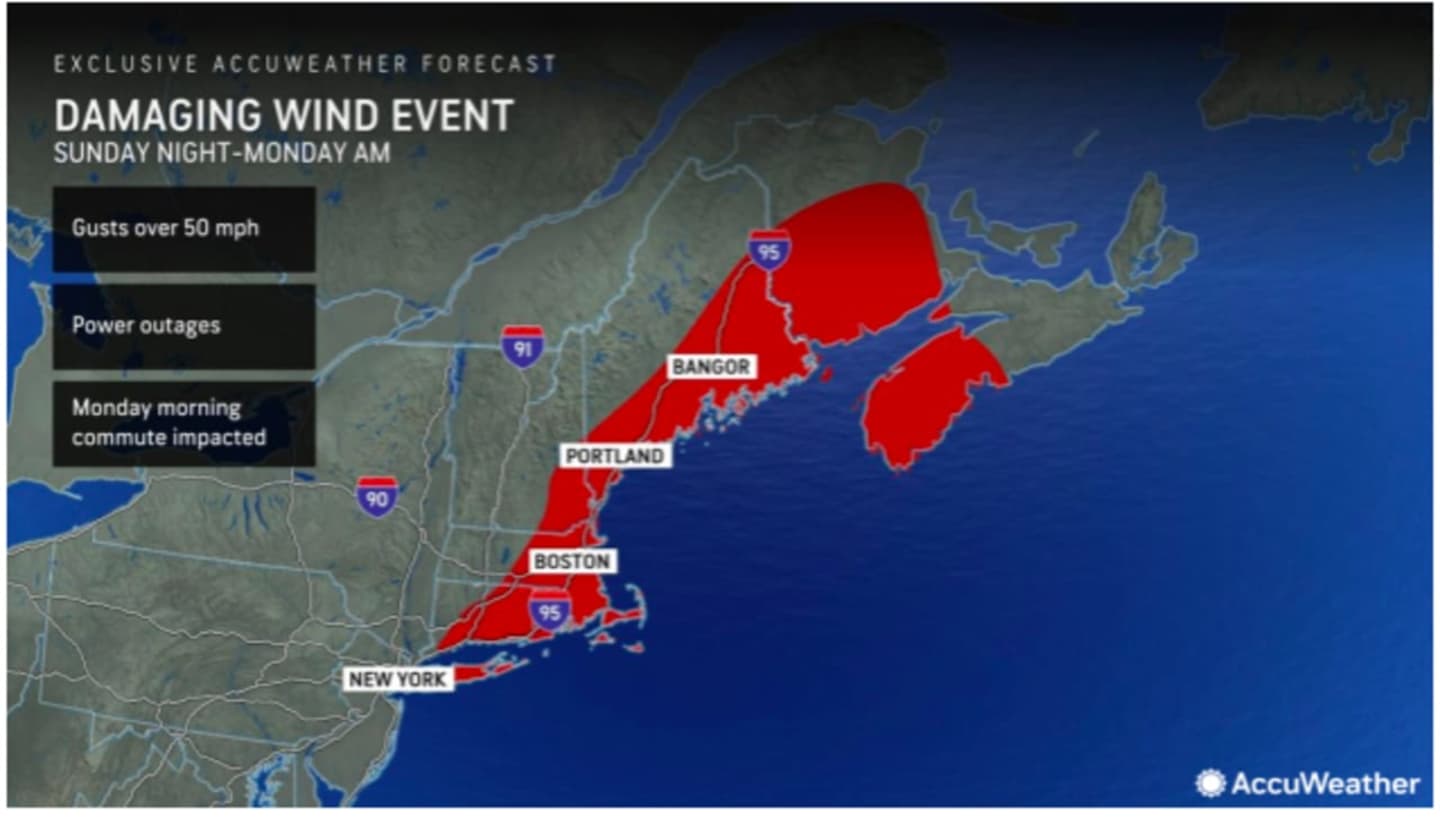
Areas shown in red in the first image above from AccuWeather.com are most likely to see scattered power outages.
A widespread 2 to 4 inches of rainfall is now expected across the region, with locally higher totals as much as 6 inches possible.
A Flood Watch has been issued for coastal areas from Sunday afternoon through late Sunday night. Localized flash flooding is possible.
High Wind Advisories are in effect for coastal areas, especially farther east, and a High Wind Warning has been issued for eastern Long Island from 4 p.m. Sunday to 11 a.m. Monday and for much of eastern Massachusetts from 10 p.m. Sunday to 10 a.m. Monday.
During that time, "Travel on the roads and around airports will be problematic, especially from late Sunday through Sunday night," says AccuWeather.com.
There is the potential for a changeover to light snow with minor accumulation across interior areas on Monday morning.
Sunday will be mostly cloudy and breezy throughout the day. The chance for rainfall will start in the early afternoon and the high temperature will generally be in the mid-50s.
On Monday, winds will be shifting to the northwest early in the morning before the system moves out from west to east starting around midday, followed by gradual clearing and even some peeks of sunshine.
"Some rain will linger for the start of the day on Monday in New York City, with gusty winds and heavier rain lingering longer in Boston," AccuWeather Meteorologist Dean DeVore said.
The passage of the cold front will usher in colder temperatures. Monday's high will be in the low 40s with the overnight low dipping to the upper 20s.
Tuesday, Dec. 12 will be mostly sunny and brisk with a high temperature of around 40 degrees.
Wednesday, Dec. 13 will be sunny with a high temperature in the upper 30s.
The outlook for Thursday, Dec. 14 calls for mainly sunny skies and a high temperature in the mid to upper 30s.
Check back to Daily Voice for updates.
Click here to follow Daily Voice Suffolk and receive free news updates.