
The time frame for the system is Tuesday, Jan. 23 into Wednesday, Jan. 24, according to the National Weather Service.
It will be cloudy throughout the day Tuesday with a high temperature generally in the mid-30s and upper 30s farther south.
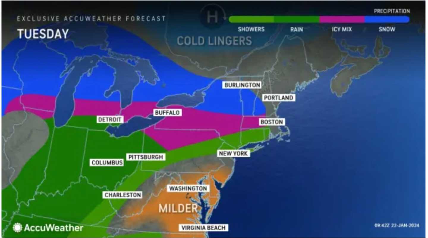
Rain will be possible starting in the afternoon Tuesday before becoming likely in the evening, when it will mix with sleet in inland areas and snow farther north. (See the first image above from AccuWeather.com.)
Parts of upstate New York and northern New England could see up to 6 inches of snowfall.
Click on the second image above from AccuWeather.com for projections: with 1 to 3 inches in areas shown in sky blue and 3 to 6 inches in Columbia blue.
Rainy weather will continue on both Thursday, Jan. 25, and Friday, Jan. 26 with a high temperature in the mid-40s on Thursday and upper 40s to around 50 degrees on Friday.
Check back to Daily Voice for updates.
Click here to follow Daily Voice Suffolk and receive free news updates.