That will change this weekend.
We'll see warmer temperatures and a round of showers. But before you think springlike conditions are here to stay, get set for a sharp drop in temps heading into the new workweek with the arrival of a cold front.
Here's what to expect and when:
Saturday, March 30: Mostly cloudy with a high in the low to mid to upper 60s during the day and evening.
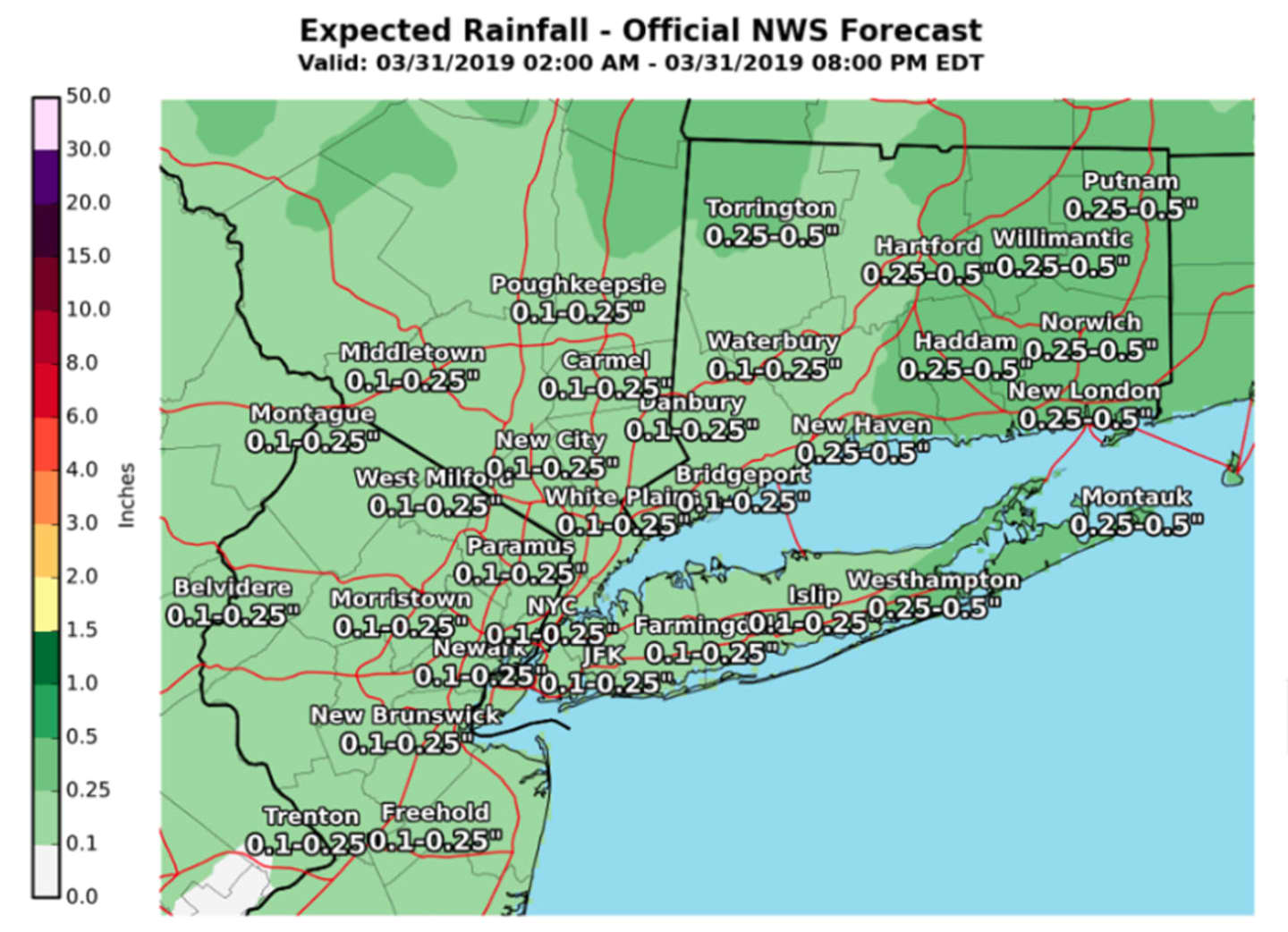
Sunday, March 31: Morning showers are likely on a mostly cloudy day with a high in the low 50s. Showers should taper off by around 2 p.m., but there will remain a slight chance of more showers through around 7 p.m. Up to a quarter inch of rain is possible. (See image above.)
Then comes the sharp drop in temperatures as the cold front arrives with the mercury falling into the upper 40s late in the afternoon.
You'll want to make sure the heat is on overnight, as the low temperature will plummet to around 30 degrees with a wind-chill factor between 20 and 25.
Monday, April 1: Sunny and breezy, with a high temperature in the mid 40s and winds up to 20 miles per hour with 30 mph gusts.
Check back to Daily Voice for updates.
Click here to follow Daily Voice Southwest Dutchess and receive free news updates.