
The storm will sweep through this region Thursday night, Feb. 3 through Friday, Feb. 4, as a cold front will move in with "quickly falling temperatures behind it," according to the National Weather Service.
Dangerous travel conditions will stretch from a large portion of Pennsylvania to the Hudson Valley of New York and Massachusetts, according to AccuWeather.com.
"The storm is a marathon, not a sprint," said AccuWeather Senior On-Air Meteorologist Justin Povick.
A small accumulation of ice and snow is expected in northern New Jersey, the lower Hudson Valley of New York and southern New England by Friday, Feb. 4, leading to slippery travel, according to AccuWeather.com.
"Rain Thursday night will change to a wintry mix from northwest to southeast, with several hours of freezing rain, sleet, and snow," the National Weather Service said in a Hazardous Weather Outlook statement. "This will lead to ice accretion on any untreated surfaces, making travel hazardous potentially for both the morning and evening commutes on Friday.
"Additionally, any standing water from rainfall and melting snow will freeze, exacerbating these conditions."
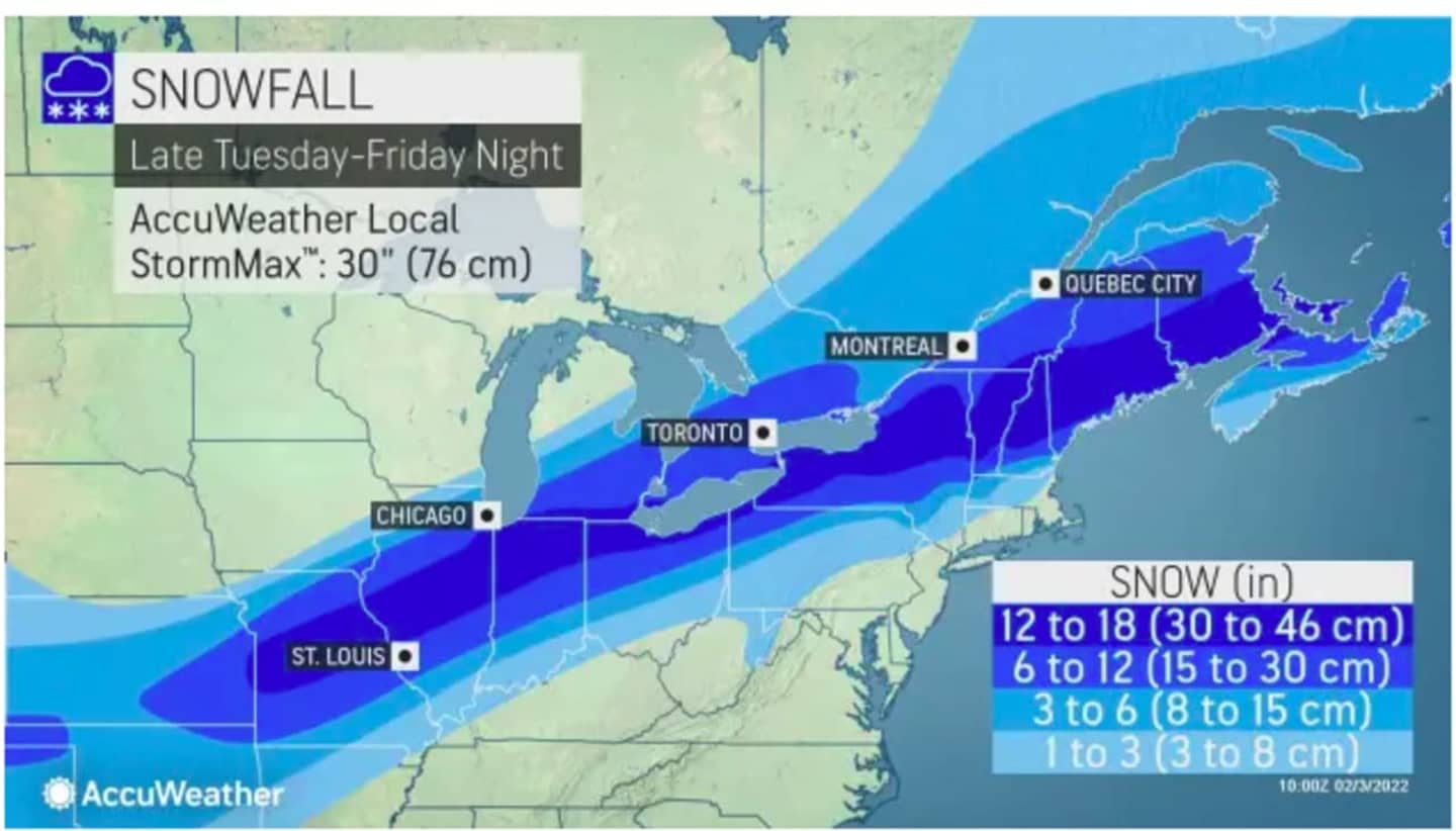
For a look at projected snowfall projections, see the first image above.
Areas at risk for some or significant ice impacts can be viewed by clicking on the second image above.
There will be rain and showers at times throughout the day on Thursday in advance of the change to a wintry mix starting in the early morning hours prior to daybreak on Friday, according to the National Weather Service.
After the messy wintry mix during the morning and afternoon on Friday, the temperature will begin to drop drastically, falling to the teens overnight into Saturday morning, Feb. 5.
That means even though Saturday will be mostly sunny, the high temperature won't climb past 30 degrees, and there will be widespread areas of dangerous ice.
Sunday, Feb. 6 will be another clear and cold day with a high temperature around the freezing mark.
Check back to Daily Voice for updates.
Click here to follow Daily Voice Southwest Dutchess and receive free news updates.