Tag:

Severe storms

Flash Flood Threat: Here's Projected Timing For System Packed With Storms, Heavy Rain Flash Flood Threat: Here's Projected Timing For System Packed With Storms, Heavy Rain
Flash Flood Threat: Here's Projected Timing For System Packed With Storms, Heavy Rain An approaching frontal system will bring thunderstorms and heavy rain that could cause flash flooding. The system will arrive from west to east early Thursday afternoon, Aug. 10, and continue to move through into the evening. Heavy rain is expected to begin in the New York City area, Hudson Valley, and Capital regions, and western Connecticut around midday Thursday and later in the afternoon in Massachusetts and eastern Connecticut. Areas where soaking rain is expected are shown in dark green in the first image above from AccuWeather.com. About an inch of rainfall is now expected, with lo…
Tornado Touched Down In NY During Round Of Severe Storms Tornado Touched Down In NY During Round Of Severe Storms
Tornado Touched Down In NY During Round Of Severe Storms A tornado touched down in New York State during a round of severe storms this week, the National Weather Service has announced following a survey of the damage. It traveled 11 miles northeasterly in Cortland and Tompkins counties from 5:13 p.m. to 5:36 p.m. Monday, Aug. 7. Its highest wind speed was 90 miles per hour and its maximum width was 200 yards as it moved from the town of Harford in Cortland County to the village of McGraw in Tompkins County. (Click on the second image above to view the path.) The twister was rated an EF-1 on the Enhanced Fujita scale, the second-weakest of th…
Super Scorcher Will Be Followed By New Round Of Severe Storms, Change In Weather Pattern Super Scorcher Will Be Followed By New Round Of Severe Storms, Change In Weather Pattern
Super Scorcher Will Be Followed By New Round Of Severe Storms, Change In Weather Pattern The hottest days of the summer will linger into the first half of the weekend before an approaching cold front ignites a new round of severe storms that will lead to a big change in the weather pattern. Friday, July 28 is likely to be the warmest day of the week -- and perhaps of the year -- with the high temperature in the mid-90s, and a heat index (the combination of the temperature and humidity) around 100 degrees or more, according to the National Weather Service. In some parts of the Northeast, the heat index could hit as high as 110 degrees. (Click on the first image ab…
Strong Storms Could Bring Damaging Winds, Hail, Isolated Tornadoes Amid Hottest Air Of Summer Strong Storms Could Bring Damaging Winds, Hail, Isolated Tornadoes Amid Hottest Air Of Summer
Strong Storms Could Bring Damaging Winds, Hail, Isolated Tornadoes Amid Hottest Air Of Summer As the hottest air mass of the season builds, a new round of scattered strong to severe storms will sweep through across the region. Strong thunderstorms will develop around midday Thursday, July 27, and track east during the afternoon and evening, the National Weather Service said.  Some storms could be severe with downpours, large hail, and damaging winds. A brief tornado is also possible, the weather service said in a Hazardous Weather Outlook statement issued early Thursday morning. Areas in orange in the first image above from AccuWeather.com have the highest …
New Update: Father, Kids Rescued From Flooded Parkway In Westchester New Update: Father, Kids Rescued From Flooded Parkway In Westchester
New Update: Father, Kids Rescued From Flooded Parkway In Westchester This story has been updated.  Busy parkways in Northern Westchester are being affected by road closures caused by severe storm activity, which also caused a father and his two children to become swept up in floodwaters.  Portions of both the Taconic State Parkway and the Sprain Brook Parkway in the town of Mount Pleasant are now closed as a storm system sweeps through, state police announced on Tuesday, July 18 around 1 p.m.  The portions of roadway affected are:  The northbound and southbound lanes of the Sprain Brook Parkway at Hospital Road. All traffic is now being diverted on Hospi…
Here's Projected Timing For New Round Of Storms With Damaging Wind Gusts, Risk For Flooding Here's Projected Timing For New Round Of Storms With Damaging Wind Gusts, Risk For Flooding
Here's Projected Timing For New Round Of Storms With Damaging Wind Gusts, Risk For Flooding New update: Line Of Severe Storms With Drenching Downpours, Damaging Wind Gusts Sweeping Through Region A cold front advancing from the Great Lakes will move through the Northeast on Tuesday, July 18, igniting isolated thunderstorms, some of which could be severe. The projected timing for storms has shifted, with activity now expected from west to east starting in the early afternoon on Tuesday, July 18. The storms could produce heavy downpours and gusty winds.  "Scattered thunderstorms are expected to develop this afternoon with heavy rain possible, bringing an isolated th…
New Flash Flood Threat: Separate Rounds Of Slow-Moving Storms Take Aim At Region New Flash Flood Threat: Separate Rounds Of Slow-Moving Storms Take Aim At Region
New Flash Flood Threat: Separate Rounds Of Slow-Moving Storms Take Aim At Region Separate rounds of slow-moving storms with heavy downpours at times will bring a new risk of flash flooding to the area into early next week. AccuWeather Chief Meteorologist Jon Porter said that a "major concern is that renewed, serious flash flooding can occur in some of the same areas that were heavily impacted by devastating and deadly flooding in the last several days because it will now take even less rainfall to result in dangerous flash flooding in these areas given how saturated the ground is.” The time frame for the first system is overnight Thursday, July 13 into Friday, July…
Roads Expected To Reopen In Westchester Following Flooding, Hochul Says Roads Expected To Reopen In Westchester Following Flooding, Hochul Says
Roads Expected To Reopen In Westchester Following Flooding, Hochul Says Several busy main roads in the Hudson Valley are expected to soon reopen following a severe storm system that dropped several inches of rain and resulted in historic flooding, officials said.  The expected road reopenings were announced on Wednesday afternoon, July 12 by New York Governor Kathy Hochul, who said that they will follow several days of intense repair work.  The closures were caused by a severe, slow-moving rainstorm that arrived in the region on Sunday, July 9, and dropped more than eight inches of rain in parts of the Hudson Valley.  Hudson Valley roadways expe…
New Update: Buses To Replace Suspended Metro-North Trains After Storms In Westchester New Update: Buses To Replace Suspended Metro-North Trains After Storms In Westchester
New Update: Buses To Replace Suspended Metro-North Trains After Storms In Westchester In the aftermath of severe storms that left Hudson Line tracks covered in water and debris, Metro-North officials have announced that a limited bus service will replace suspended trains in the Hudson Valley.  The limited bus service will begin serving the Hudson Line at around 1 p.m. on Monday, July 10, and will make stops between the Croton-Harmon and Poughkeepsie stations, MTA officials announced.  Earlier Report - Metro-North Railroad Announces Service Changes Due To Storm Damage These stops will include the Cortlandt and Beacon stations as well.  The buses wil…
Metro-North Railroad Announces Service Changes Due To Storm Damage Metro-North Railroad Announces Service Changes Due To Storm Damage
Metro-North Railroad Announces Service Changes Due To Storm Damage New Updates:  Buses to Replace Suspended Metro-North Trains After Severe Storms In Hudson Valley At Least 1 Dead After Severe Storms With Flash Flooding Pound Hudson Valley Due to the impact of severe storms in the Hudson Valley leaving behind high water, trees, boulders, and other debris, sections of Metro-North's Hudson Line tracks north of Croton-Harmon have become impassable.  As a result, Metro-North Railroad service between Croton-Harmon and Poughkeepsie has been suspended, and is expected to remain unavailable at least through the day Monday. Crews will be working to eval…
Thunderstorms, Some Severe, Sweeping Through Region: Here's Latest Thunderstorms, Some Severe, Sweeping Through Region: Here's Latest
Thunderstorms, Some Severe, Sweeping Through Region: Here's Latest A line of thunderstorms, some severe, is sweeping through the region from west to east. Storm activity first began in areas west of the Hudson River in the early afternoon on Friday, July 7. Most of the severe storms from the system are farther inland, especially north of Interstate 84. (A radar image of the region at about 4 p.m. is shown in the image above.) But storm activity is expected to become more widespread late Friday afternoon into the middle of the evening. A widespread, more significant storm is predicted for Sunday, July 9. Between 2 and 3 inches of rainfall is expected wit…
Roof Ripped Off High School In Hudson Valley During Round Of Severe Storms Roof Ripped Off High School In Hudson Valley During Round Of Severe Storms
Roof Ripped Off High School In Hudson Valley During Round Of Severe Storms The roof of a high school building in the Hudson Valley was peeled off during a round of severe storms. The incident happened in Orange County when the storms swept through late Monday afternoon, July 3. The building affected in the village of Chester was the old Chester High School on Maple Avenue, which is currently used for BOCES classes. No one was in the building at the time and no injuries were reported, according to Mark Lieb of Rockland Video Productions.  After the incident, Chester Union Free School District Superintendent Catherine O'Hara said safety measures wer…
Severe Weather Threat: Scattered Storms Could Bring Damaging Winds, Hail, Isolated Tornadoes Severe Weather Threat: Scattered Storms Could Bring Damaging Winds, Hail, Isolated Tornadoes
Severe Weather Threat: Scattered Storms Could Bring Damaging Winds, Hail, Isolated Tornadoes There will be a threat of severe storms in much of the region with damaging winds, flash flooding, hail, and isolated tornadoes possible. The storms are expected to develop in the mid-Atlantic and track east by late in the afternoon on Monday, June 26. (See the first image above from AccuWeather.com.) Hail could be around 1 inch in diameter, the National Weather Service said in a Hazardous Weather Outlook statement issued early Monday morning. "Localized flash flooding is also possible," the statement said. It will be cloudy throughout the day on Monday with the h…
Overnight Severe Storms Knock Out Power To Thousands In Parts Of Hudson Valley Overnight Severe Storms Knock Out Power To Thousands In Parts Of Hudson Valley
Overnight Severe Storms Knock Out Power To Thousands In Parts Of Hudson Valley Thousands lost power after powerful storms moved through the region overnight. More than 39,000 customers in the area of Ulster and Dutchess counties lost power Sunday night, July 24, Central Hudson said. The company said as of 8:30 a.m. on Monday, about 23,000 customers remained without power. “Our crews are working to address more than 500 individual damage locations after a line of severe thunderstorms brought winds of over 50 miles per hour to portions of our service area,” said Ryan Hawthorne, vice president of Electric Engineering and Operations at Central Hudson. “Along with our ful…
Line Of Severe Thunderstorms Moving West To East With Strong Wind Gusts, Small Hail, Lightning Line Of Severe Thunderstorms Moving West To East With Strong Wind Gusts, Small Hail, Lightning
Line Of Severe Thunderstorms Moving West To East With Strong Wind Gusts, Small Hail, Lightning A line of severe storms is moving through the region from west to east on Saturday afternoon, May 28. Storm activity is expected to continue into early Saturday evening. A slow moving cold front is triggering the system, according to the National Weather Service. Lightning alerts have been issued for parts of the region. Strong gusty winds in excess of 40 miles per hour, half-inch hail, and locally heavy rain have been reported. "Gusty winds could knock down tree limbs and blow around unsecured objects," the National Weather Service said in a Special Weather Statement issu…
Severe Thunderstorms With Wind Gusts Up To 50 MPH Could Cause Power Outages Severe Thunderstorms With Wind Gusts Up To 50 MPH Could Cause Power Outages
Severe Thunderstorms With Wind Gusts Up To 50 MPH Could Cause Power Outages A strong cold front will move across the region bringing a line of severe storms and damaging wind gusts up to around 50 miles per hour that could cause power outages. Saturday, Dec. 11 will be mostly cloudy with showers at times before the front moving from west to east arrives around 6 p.m. Potentially record-high temperatures will climb to the low 60s, but it won't feel as warm as winds begin to pick up around noontime and continue through the evening and into the overnight. Sustained winds out of the southwest will be 10 to 20 miles per hour with gusts up to 40 to 50 mph that …
Sixth Tornado Touchdown From Severe Storms Confirmed In New York Sixth Tornado Touchdown From Severe Storms Confirmed In New York
Sixth Tornado Touchdown From Severe Storms Confirmed In New York A sixth tornado from the quick-moving round of severe storms that swept through the region has been confirmed to have touched down in New York. All six were on Long Island on Saturday, Nov. 13, with the latest identified in Hampton Bays in Suffolk County, the National Weather Service announced late Tuesday night, Nov. 16. It has been classified as an EF-0 twister (the weakest of the six levels on the Enhanced Fujita Scale), due to its wind speed.  The four other tornadoes that touched down on Long Island on Saturday are: Nassau County EF-0: Woodmere-Hempstead-Uniondale-Levittown Suf…
Tornado Touchdown Confirmed In Hudson Valley Tornado Touchdown Confirmed In Hudson Valley
Tornado Touchdown Confirmed In Hudson Valley Updated story: Confirmed Tornado Touched Down In Three NY Locations The first tornado touchdown has been confirmed following separate rounds of storms over the last few days in the region. The National Weather Service announced on late Sunday morning, Nov. 14 the twister happened in New York's Hudson Valley, in eastern Dutchess County, in the town of Washington, on the first day of the back-to-back storms, on Friday, Nov. 12 at 11:15 a.m. It rated EF-1 (the second-weakest of the six levels on the Enhanced Fujita Scale). It had a maximum sustained wind speed of 90 miles per h…
Severe Storms Will Bring Damaging Wind Gusts, Flash Flood Risk, Tornado Threat To Region Severe Storms Will Bring Damaging Wind Gusts, Flash Flood Risk, Tornado Threat To Region
Severe Storms Will Bring Damaging Wind Gusts, Flash Flood Risk, Tornado Threat To Region A cold front will trigger separate rounds of showers and thunderstorms, some of which could be severe with damaging wind gusts and the threat of flash flooding,  large hail, and a few tornadoes. The time frame for storm activity is late Wednesday afternoon, Sept. 15 into Thursday, Sept. 16. Wednesday will be hazy, warm, and humid during the day with the high temperature in the mid 80s. The storm chance will start late in the afternoon when a line of strong to severe storms is expected to move from the west to the east.  Wind gusts of 45 miles per hour are possible with some of t…
Severe Thunderstorm Watch In Effect, With 60 MPH-Plus Wind Gusts Expected, Tornadoes Possible Severe Thunderstorm Watch In Effect, With 60 MPH-Plus Wind Gusts Expected, Tornadoes Possible
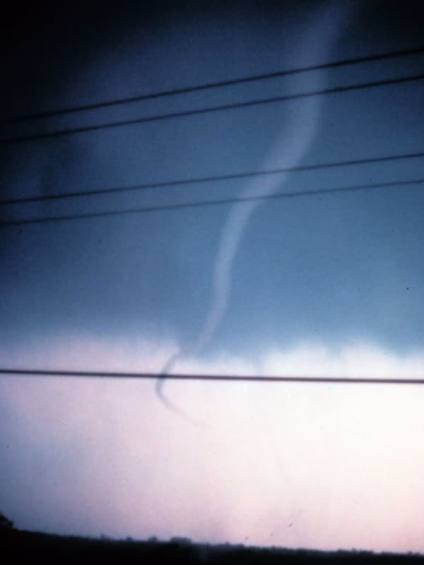
Severe Thunderstorm Watch In Effect, With 60 Mph-plus Wind Gusts Expected, Tornadoes Possible A Severe Thunderstorm Watch has been issued for a large portion of the Northeast. It's in effect until 11 p.m. Saturday, July 17. 
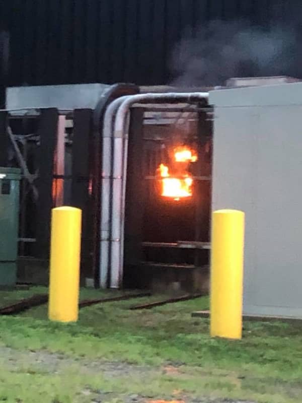
Damaging wind gusts in excess of 60 miles per hour are the main threat with any thunderstorm that becomes severe, the National Weather Service said in issuing the watch. Torrential downpours, frequent lightning, and flash flooding are all possible, along with quarter-size hail. A Flash Flood Watch remains in effect until Sunday morning, July 18. Earlier report: Severe Storms Expected With 70 MPH Wind Gusts, Drenching Downpours, Possible Tornadoes Fo…
New York State Agencies Announce Storm Emergency Preparation Efforts New York State Agencies Announce Storm Emergency Preparation Efforts
New York State Agencies Announce Storm Emergency Preparation Efforts With a wave of potentially severe storms set to move into the New York area, state agencies have been planning their emergency response effort. Some downstate areas could experience up to four inches of rain, and wind gusts could reach up 60 miles per hour, the National Weather Service. The State said that the Department of Transportation has the following assets prepared to respond: 1,395 large dump trucks 74 wheeled and tracked excavators 306 large loaders 17 vacuum trucks with sewer jets 20 graders 15 tree crew bucket trucks 77 chippers Additionally, the state said the New York St…
Storms With Downpours, Damaging Winds Sweeping Through Region Storms With Downpours, Damaging Winds Sweeping Through Region
Storms With Downpours, Damaging Winds Sweeping Through Region The new workweek is off to a stormy start. Scattered storms, some of which could be strong to severe, will continue through the day and evening on Monday, June 14, into Tuesday morning, June 15. Downpours, damaging winds, and hail are possible with any possibly severe storms. Monday's high temperature will be in the low 70s, with high humidity levels of around 90 percent. After morning showers, and possible thunderstorms, wrap up by late Tuesday morning, it will become partly sunny during the afternoon with a high temperature in the upper 70s. Following the unsettled stretch, Wednesday, …
Man Killed When Tree Falls On Compact SUV In Hudson Valley Man Killed When Tree Falls On Compact SUV In Hudson Valley
Man Killed When Tree Falls On Compact SUV In Hudson Valley A Hudson Valley man was killed when a tree fell on a vehicle during the height of the severe round of storms last week. At approximately 4:22 p.m. on Thursday, Aug. 27, state police troopers in Dutchess County responded to the area of mile marker 43.4 on the Taconic State Parkway in East Fishkill for a report of a tree falling on a vehicle.  An investigation revealed the 2019 Toyota RAV4 was traveling northbound when a tree fell on the vehicle due to storm activity, state police said.  The front passenger, Willie J. Dinkins, 73 years, of Pleasant Valley, was pronounced dead at th…
Tornado Watch Now In Effect For Westchester County Tornado Watch Now In Effect For Westchester County
Tornado Watch Now In Effect For Westchester County A Tornado Watch has just been issued for nearly the entire region. It's in effect until 8 p.m. Thursday, Aug. 27, the National Weather Service said. It was issued just before 3:30 p.m. Thursday. It covers Westchester, Putnam, Rockland and Orange counties in the Hudson Valley, Suffolk County on Long Island and Fairfield County in Connecticut. The watch comes as a new round of severe storms is expected to sweep through the area. The main threats, including the potential for tornadoes, are damaging wind gusts up to 70 mph, golf-ball size hail, brief heavy downpours and local flash flooding. …
Tornado Watch Issued For Parts Of Region, With 70 MPH Wind Gusts, Large Hail Also Possible Tornado Watch Issued For Parts Of Region, With 70 MPH Wind Gusts, Large Hail Also Possible
Tornado Watch Issued For Parts Of Region, With 70 MPH Wind Gusts, Large Hail Also Possible Click here for a new, updated story: Tornado Watch Now In Effect For Most Of Region A Tornado Watch has just been issued for parts of the region. It's in effect until 7 p.m. Thursday, Aug. 27, the National Weather Service said. It was issued just before 1:30 p.m. Thursday. It covers Ulster, Sullivan, Dutchess and several other upstate counties in New York, Litchfield County in Connecticut and Berkshire County in Massachusetts. (See the image above.) The watch comes as a new round of severe storms is expected to sweep through the area. The main threats, including the potential for…
Tornado Touched Down In New York, National Weather Service Confirms Tornado Touched Down In New York, National Weather Service Confirms
Tornado Touched Down In New York, National Weather Service Confirms A tornado touched down in New York State when a round of severe storms sweep through the region Friday night, May 15, the National Weather Service confirmed. The twister was in one of the northern areas of New York and Connecticut in which a Tornado Watch was in effect. It touched down between 5:59 p.m. and 6:01 p.m. Friday in Wilton, New York, located near I-87 in Saratoga County, where it blew away and displaced street signs and uprooted and snapped a string of trees, with some falling on top of houses, according to the National Weather Service. It also peeled off part of the sheeting of…
New Round Of Severe Storms Will Include Drenching Rain, Lightning, Flash Flooding New Round Of Severe Storms Will Include Drenching Rain, Lightning, Flash Flooding
New Round Of Severe Storms Will Include Drenching Rain, Lightning, Flash Flooding A dry start to the workweek will be followed by an unsettled stretch that will include a new round of severe storms. Monday, Aug. 5 will be mostly sunny and pleasant with a high temperature in the low 80s. An increase in humidity on Tuesday, Aug. 6 will lead to conditions conducive for storms. On a mostly cloudy day with a high in the mid 80s, there is a chance of showers and thunderstorms both in the morning and in the evening. Wednesday, Aug. 7 will be the stormiest day of the week with some of those storms being severe, with the main threat being gusty winds. Drenching rain, thund…
Lightning Strike Cited In Fire At Business Complex In Westchester Lightning Strike Cited In Fire At Business Complex In Westchester
Lightning Strike Cited In Fire At Business Complex In Westchester An electrical fire at a business complex in Westchester is believed to have been started by a lightning strike. The fire began amid a round of severe storms around 7:15 p.m., Monday, July 22, at 777 Old Saw Mill River Road, in Hawthorne, where Regeneron Pharmaceuticals is located, said the Hawthorne Fire Department. Hawthorne responded along with Elmsford Fire Department for a fire next to the structure, Hawthrone Fire said. Shortly after dispatch, Car 2192 and 2111 were on scene updating the call as a working transformer fire attached to the building and requested Con Ed to the scene. Cr…
Severe Storms With Fierce Winds Bring Big Change In Weather Pattern Severe Storms With Fierce Winds Bring Big Change In Weather Pattern
Severe Storms With Fierce Winds Bring Big Change In Weather Pattern Thousands are starting the new month in the dark, despite the bright, sunny skies. That's because rounds of severe, isolated storms with fierce winds toppled trees, tree limbs and utility lines, causing tens of thousands of power outages throughout the region on Sunday, June 30. The storms were triggered by a cold front that has brought about a big change in the weather pattern as we head toward the long July 4th weekend. Monday, July 1 will be sunny and much less humid with a high temperature in the low 80s. (For projected high temperatures throughout the region, see first image above.) …
New Round Of Rain, Storms Will Soak Area To Start Mother's Day Weekend New Round Of Rain, Storms Will Soak Area To Start Mother's Day Weekend
New Round Of Rain, Storms Will Soak Area To Start Mother's Day Weekend A warm front that swept through the area overnight will bring about some big changes in the weather pattern. Here's the outlook through the weekend: Friday, May 10: Cloudy and warmer with a high near 70 degrees. There's a chance for showers during the morning and afternoon with isolated thunderstorms moving in after sunset. Severe storms and gusty winds are possible. The most likely time frame for storms is from 7 p.m. until around midnight.  Saturday, May 11: The showers and storms will lead to a delightful day on Saturday, which will be mostly sunny with a high in the mid 60s a…
New Round Of Gusty Thunderstorms Will Sweep Through Area New Round Of Gusty Thunderstorms Will Sweep Through Area
New Round Of Gusty Thunderstorms Will Sweep Through Area There will be a big change in the weather pattern after what's been a dry week so far. Showers and gusty thunderstorms will sweep through the area with locally damaging winds the main threat. Here's the outlook through the weekend: Friday, May 10: Cloudy and warmer with a high in the upper 60s. There's a chance for showers during the morning and afternoon with isolated thunderstorms arriving after 3 p.m. and storms becoming more likely after sunset, with severe storms and gusty winds possible. The storm chance will continue through the late evening. Saturday, May 11: The showers…