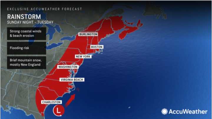
The time frame for the latest system is Sunday, Dec. 17 into Monday, Dec. 18, with the heaviest precipitation on Monday, the National Weather Service says.
"This next storm coming up the Eastern Seaboard will have similar characteristics to the one that slammed the mid-Atlantic and Northeast with heavy rain and wind just days ago," said AccuWeather Senior Meteorologist Joe Lundberg.
The current outlook calls for temperatures to be above freezing during most of that time frame, meaning there will be widespread heavy rainfall at times, with some snow in spots in northern New York and New England, especially Monday night and possibly into Tuesday morning, Dec. 19.
Snow could extend into interior areas farther south Monday evening into Tuesday as the storm is expected to persist and temperatures drop.
Some current forecast models predict between 3 and 4 inches of rainfall from the storm, with flooding possible.
Rain could lead to flooding, causing travel difficulties on Monday.
Temperatures will rebound to end the week on Friday, Dec. 15, and Saturday, Dec. 16 with the high temperature ranging from the upper 40s to low 50s with mostly sunny skies both days.
Skies will thicken overnight Saturday, leading to a mostly cloudy day on Sunday ahead of the storm's arrival. The high temperature will be in the upper 40s.
There's still some uncertainty surrounding the strength and timing of the storm, but current projects have rainfall arriving from the south in the early to middle of the afternoon on Sunday. (See the image above.)
Check back to Daily Voice for updates.
Click here to follow Daily Voice Clifton Park and receive free news updates.
