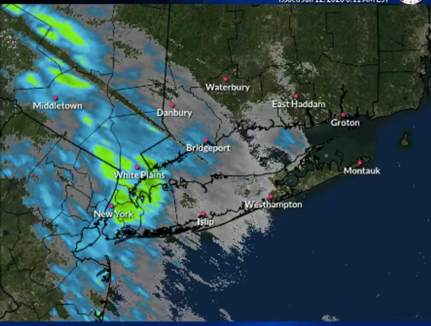


A radar image above from about 7 a.m. Thursday by the National Weather Service shows the system moving from west to east.
The high temperature will climb to around the 50-degree mark Thursday and rain will become more widespread during the day, according to the National Weather Service.
The potent storm is expected to intensify Thursday night with heavy rain at times, possible thunderstorms, and wind gusts as high as between 30 and 35 miles per hour.
In most of the Northeast, mainly rain is expected during the duration of the storm with a wintry mix possible farther inland (pink) and snow in those parts of northern New York and New England (blue). Click on the second image above from AccuWeather.com.
Northern New York and New England could see up to 6 inches of snowfall. (Click on the third image a
Rain is expected to continue at times until around midday Friday, Jan. 13 on a mostly cloudy day in which the temperature will fall during the afternoon into the mid 40s with strong winds, including gusts up to around 25 mph.
The current outlook for Saturday, Jan. 14 calls for mostly sunny skies with a high temperature ranging from the mid to upper 30s to low 40s.
Check back to Daily Voice for updates.
Click here to follow Daily Voice Rivertowns and receive free news updates.