

The slow-moving system made its second landfall as a tropical storm just before 2 a.m. Thursday, Aug. 8, near Bulls Bay, South Carolina, three days after its initial landfall as a Category 1 hurricane along the west coast of Florida before stalling out in the Southeast.
The time frame for isolated severe storms with damaging wind gusts and possible brief tornadoes will be from Friday morning, Aug. 9, into Saturday morning, Aug. 10, as Debby merges with a cold front that will push through.
During that time, winds will be out of the south between 20- and 30 miles per hour with gusts up to 45 mph possible, especially along the coast, where there will be high surf and the risk of rip currents along ocean beaches.
"Minor tree damage and power outage impacts are possible," according to the National Weather Service.
Urban, poor drainage, and river/stream flooding from heavy rain and saturated grounds are also expected.
The temperature will rise to a high of around 80 degrees on Friday.
There will be rain, which could be heavy at times, showers during the day and evening, and storms at times. Some of the storms could be severe.
Precipitation will linger into Saturday before tapering off in the early afternoon, followed by gradual clearing. The high temperature will again be around 80 degrees.
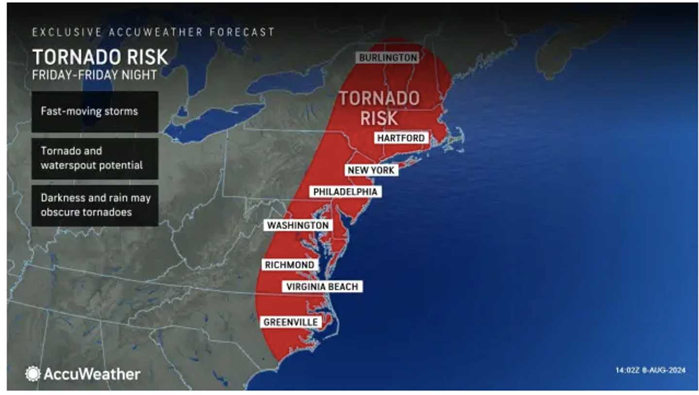
Areas in the first image from AccuWeather.com are at risk for tornadoes.
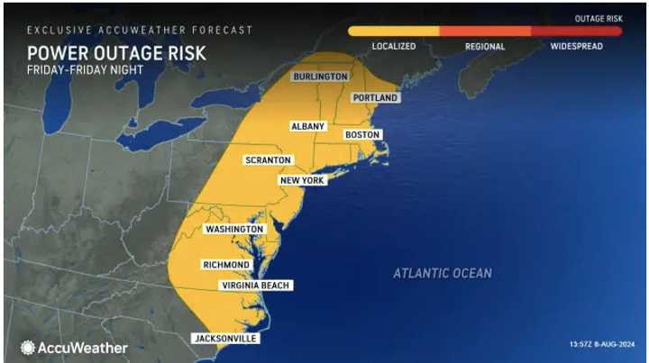
The second image above shows locations where 40 to 50 mph winds are expected, and the third image shows areas where there could be power outages.
Click on the fourth image above to see projected rainfall amounts.
Check back to Daily Voice for updates.
Click here to follow Daily Voice Rivertowns and receive free news updates.