The time frame for the first storm is Thursday night, Feb. 15 into the early morning hours of Friday, Feb. 16, according to the National Weather Service.
The second system is due to arrive overnight Friday into early Saturday afternoon, Feb. 17.
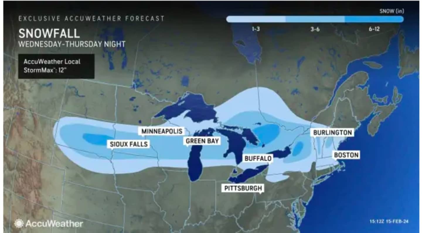
Unlike the storm that moved through on Tuesday, Feb. 13, the first system will dump the most snow in areas farthest north and inland.
In a brand-new snowfall forecast map from AccuWeather.com released on Thursday afternoon shown in the image above, areas in sky blue are expected to see 1 to 3 inches of accumulation, with 3 to 6 inches in those spots shaded in Columbia blue.
Up to 6 inches to a foot of snowfall is possible in the area in upstate New York shown in the darkest shade of blue.
The storm system will bring a mix of snow showers, sleet, and rain showers to areas farther south Thursday night after nightfall before it quickly moves out in the early morning hours well before daybreak on Friday, the National Weather Service said.
In those areas, "snow can cause poor visibility and slippery spots, leading to slow travel," according to AccuWeather.com.
Skies will quickly become sunny on Friday morning on what will be a breezy day with strong winds between around 10 and 25 miles per hour and gusts up to around 30 miles per hour. The high temperature will generally be in the upper 30s.
The timing for snowfall from the second system is overnight Friday into around 2 p.m. Saturday for most of the region and from around daybreak until nightfall on Saturday in areas farthest east.
It's still uncertain if the storm will be strong enough to produce accumulating snowfall, but current projections are calling for no more than a trace to an inch or so.
After the system pushes through, there will be gradual clearing on Saturday afternoon as the high temperature reaches the mid-30s.
That will lead to a mostly sunny day Sunday, Feb. 18 with temperatures in the mid-30s.
The outlook for Presidents Day on Monday, Feb. 19 calls for sunny skies with the mercury climbing out of the 30s for the first time in five days with a high in the low 40s.
Check back to Daily Voice for updates.
Click here to follow Daily Voice Putnam and receive free news updates.