Storm activity on Saturday, Aug. 3, will occur late afternoon into late evening.
According to the National Weather Service, heavy downpours may result in isolated to scattered instances of flash flooding.
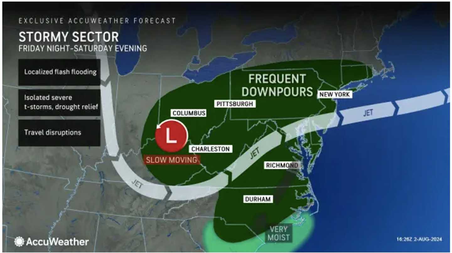
To look at the broad area where storms are expected, see the image above from AccuWeather.com.
The system will come after a mainly dry Saturday with a mix of sun and clouds. The high temperature will be around 90 degrees, with heat index values in the upper 90s.
Saturday, Aug. 4, will be mostly cloudy throughout the day, helping to keep the high temperature in the low 80s.
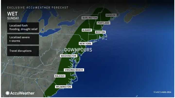
A new round of showers and storms is likely from around midday through the rest of the afternoon. Downpours are possible. (Click on the second image above.)
Skies will gradually clear overnight, leading to a sunny day on Monday, Aug. 5, with a high temperature back up to around 90 degrees.
Check back to Daily Voice for updates.
Click here to follow Daily Voice Pelham and receive free news updates.