
Widespread wind gusts will be around 25 miles per hour during the height of the system.
About an inch to 2 inches of rainfall is expected with locally higher amounts possible.
Areas in upstate New York and northern New England are expected to see a mix of snow and sleet.
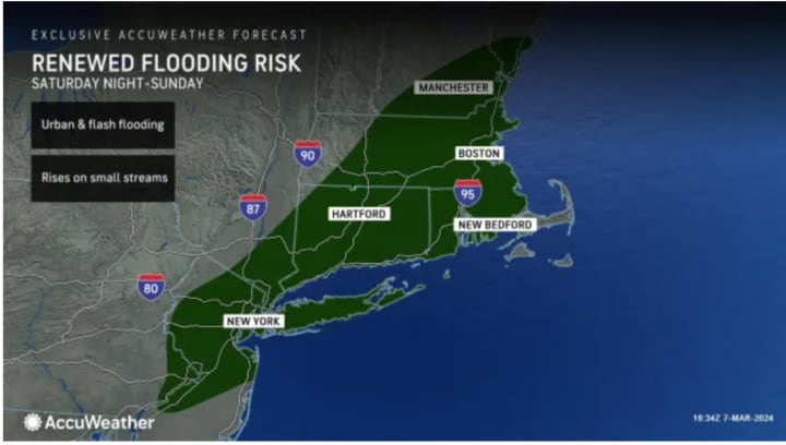
During the height of the storm, thunderstorms are possible, and a broad area could see flooding. (Click on the second image above from AccuWeather,com.)
The highest snowfall amounts of 6 inches to a foot of snow are expected in the areas in the darkest shade of blue that can be viewed by clicking on the third image above.
Behind the storm, even stronger winds are likely Sunday morning through Monday, March 11, according to the National Weather Service.
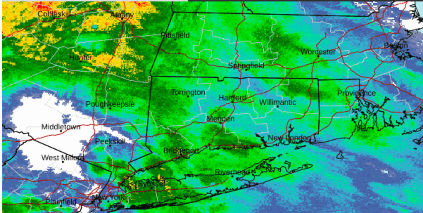
Hours of heavy rain will continue throughout the region on Saturday night into Sunday morning when clocks "Spring Ahead" an hour at 2 a.m. Sunday for the start of Daylight Saving Time.
"The heaviest of the rain is expected to occur this evening into the overnight hours," the National Weather Service said in a Hazardous Weather Outlook statement issued late Saturday afternoon. "The steady rainfall should end by daybreak Sunday.
"Due to saturated conditions from the recent rainfall events earlier this week, quick responding rivers and streams may reach or exceed bankfull. In addition, coastal flooding may exacerbate flooding on tidal rivers."
Sunday will be mostly cloudy and breezy with a high temperature in the upper 40s to around 50 degrees and a chance of rain showers.
Skies will brighten up on Monday which will be mostly sunny and windy, with a high temperature in the low to mid-40s.
Tuesday, March 12 will be sunny with temperatures in the low 50s.
The outlook for Wednesday, March 13 calls for a mix of sun and clouds with a high temperature in the mid-50s.
Check back to Daily Voice for updates.
Click here to follow Daily Voice North Salem and receive free news updates.