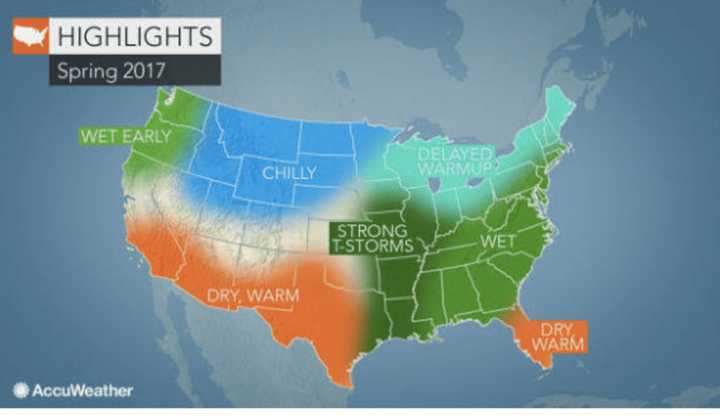
But that trend will not linger through the start of spring on March 20, according to AccuWeather.com.
Spring will start off on a wet note for the area as rain and snow will fall through mid-March in most of the Northeast, holding back temperatures.
"As far as a significant warmup goes in the Northeast, I think you have to hold off until late April and May," said AccuWeather Lead Long-Range Forecaster Paul Pastelok.
Nevertheless, according to Pastelok, the warmup should arrive faster than in the past couple of years.
Wintry conditions will return across the area in March with rain and snow frequenting the region, AccuWeather said.
But there's no snow in sight for this week.
Presidents Day will be sunny with a high around 50.
Temperatures will dip Tuesday with a high in the low 40s under mostly sunny skies.
Wednesday will once again be mostly sunny and warmer, with a high in the upper 50s.
Record-setting high temperatures are possible throughout the area Thursday as the temperature soars to between 66 and 68 degrees under partly sunny skies.
There will be a chance of showers after noon Friday with a high in the mid-50s.
Check back to Daily Voice for updates.
Click here to follow Daily Voice Mount Pleasant and receive free news updates.
