New update - Projected Snowfall Totals Increase As Nor'easter Nears: These Spots Could See 18 Inches
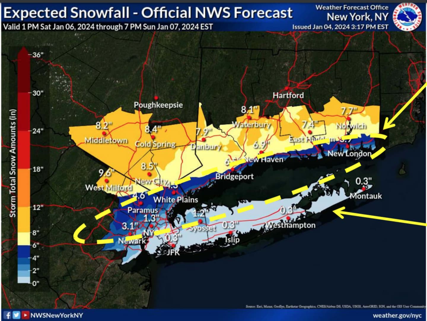
New York City and Long Island could see an inch or less of accumulation, but just a couple dozen miles north, including parts of Westchester and Rockland, 8 inches may fall. Orange and Putnam counties could also see around 8 inches or more, the National Weather Service says. (See the first image above.) Heavy snow is expected at times.
A Winter Storm Watch for areas north of NYC and Long Island goes into effect at 6 p.m. Saturday, Jan. 6, and lasts through67 p.m. Sunday, Jan. 7. Travel could be very difficult during that time, the National Weather Service is warning.
The National Weather Service says that the wide range of possible snowfall totals is due to remaining uncertainty on the exact storm track "and intensification and the location of the rain/snow line within 30 miles.
"A storm track farther offshore and/or stronger will move the rain/snow line southeast, resulting in higher snowfall totals for the city/coast.
"Snow amounts could be 1 to 3 inches higher than forecast for the city/coast if snow banding develops to the coast Sunday afternoon.
"The fine details of this forecast will be refined as the event nears, but may not be evident until the storm is underway."
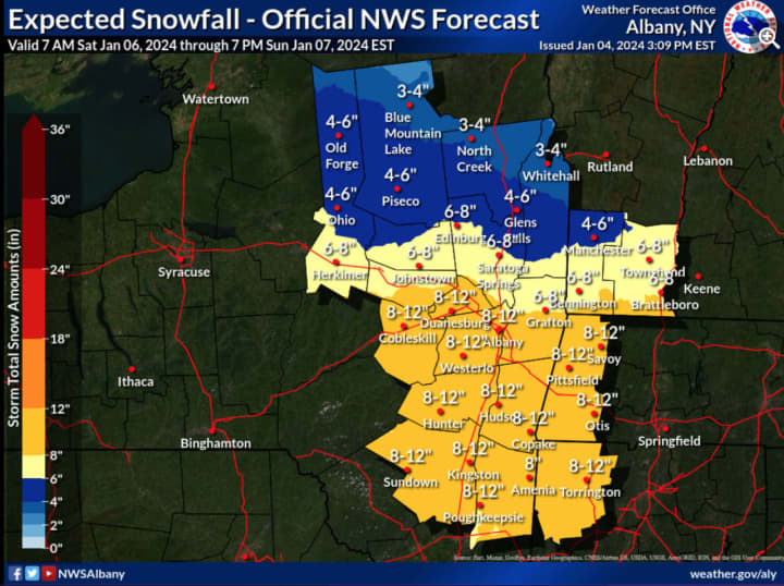
For a look at areas in upstate New York where up to a foot of snow is possible, click on the second image above.
During the storm's height, winds will be out of the Northeast at 20 to 25 miles per hour with gusts of 35 to 45 mph, with strongest gusts near the coast, especially in areas farthest east.
This continues to be a developing story. Check back to Daily Voice for updates.
Click here to follow Daily Voice Mount Pleasant and receive free news updates.