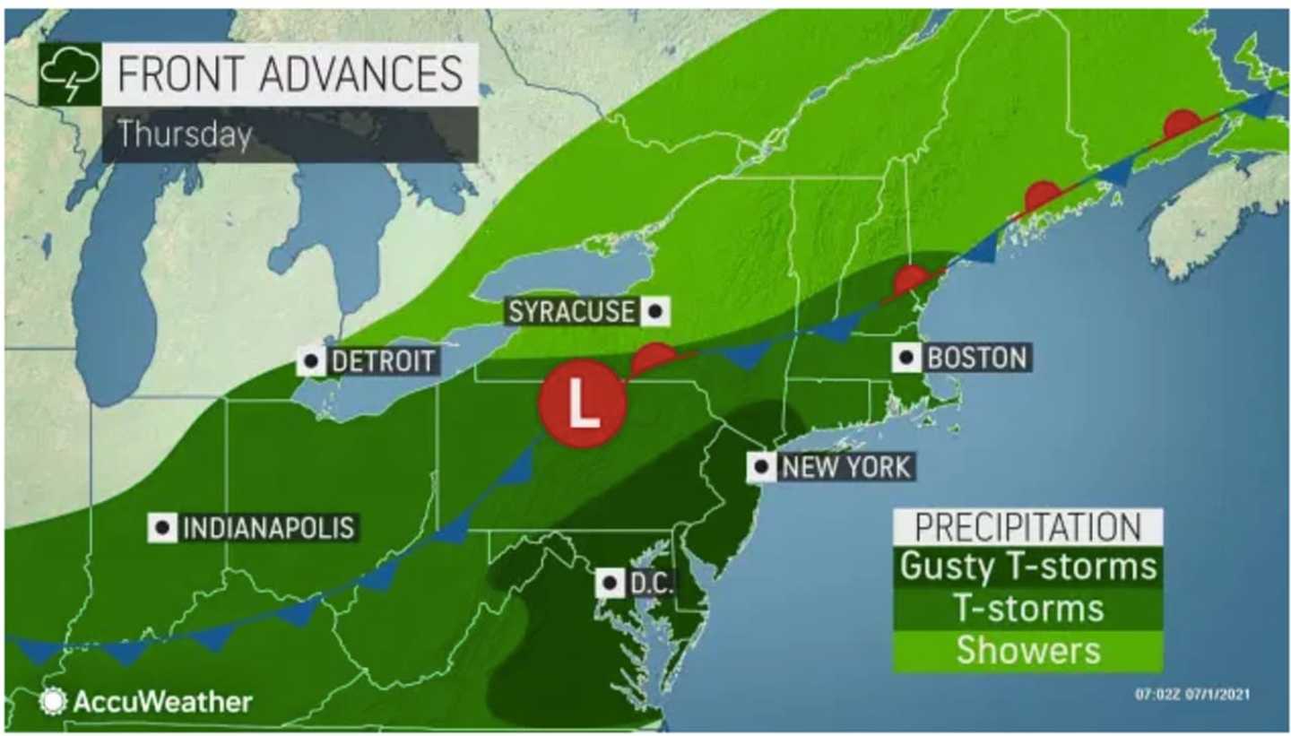

The time frame for storms on Thursday, July 1 is in the afternoon and evening. (See the first image above.)
"This activity will bring a threat for localized to scattered areas of flash flooding and localized strong to damaging wind gusts," the National Weather Service said.
Rainfall rates of 1 to 2 inches per hour are possible at times.
More severe storms are expected farther south on Thursday, July 1 than from the system on Wednesday, June 30. (Click on the second image above.)
The arrival of the slow-moving front has ended a three-day heatwave in which temperatures reached the 90s each of the previous three days.
Check back to Daily Voice for updates.
Click here to follow Daily Voice Lewisboro and receive free news updates.