A stormy stretch that will arrive after Easter will include a chance for some spring snowfall in parts of the Northeast.
Easter Sunday, March 31 will be partly to mostly sunny with a high temperature in the mid to upper 50s.
Clouds will thicken as the calendar flips to a new month on Monday, April 1, marking the beginning of a days-long stormy period.
Rain is likely both during the day and again at night on Monday as the high temperature will range from the upper 40s to around 50 degrees.
There will be rain throughout the day Tuesday, April 2, and Wednesday, April 3 with a high temperature in the mid-40s both days.
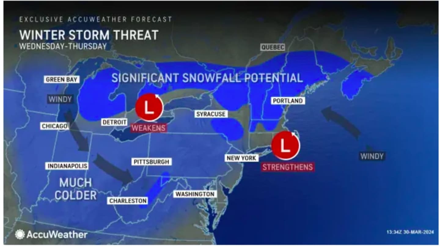
Overnight Wednesday into Thursday, April 4, there is expected to be a mix of snow and rain, with significant snowfall possible in upstate New York and northern New England. (See the image above from AccuWeather.com.)
“Wednesday into Thursday, there will be just enough cold air in place that a late-season, wet snowfall is likely to occur across the interior of northern and central New England, with significant accumulations in the mountains," said AccuWeather Senior Meteorologist Dan Pydynowski. "Though the interior and the higher terrain is likely to experience the greatest amounts of snowfall, there is enough cold air in place that snowflakes could mix in all the way to Boston by late Wednesday into Thursday with some accumulations possible across the Worcester Hills.”
It's too early to predict potential snowfall amounts for those inland areas.
Check back to Daily Voice for updates.
Click here to follow Daily Voice Greenburgh and receive free news updates.