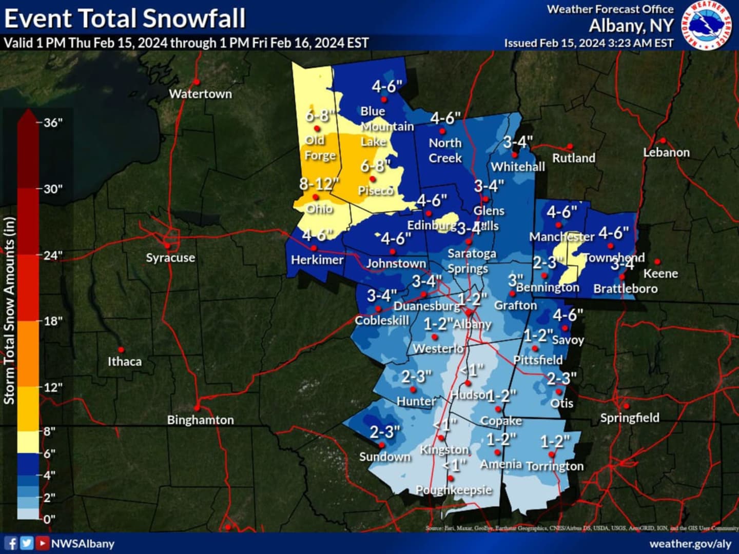


The map shown above from the National Weather Service projects the highest amounts in areas shown in orange where 8 inches to a foot is possible.
In spots shaded in yellow, 6 to 8 inches is expected.
A widespread 3 to 6 inches is forecast in areas in the darker shades of blue.
Farther south, including Dutchess and Columbia counties, about an inch or so is predicted (areas in sky blue).
Snow is expected to begin around 8 p.m. Thursday and wind down at around 2 a.m. Friday.
A Winter Weather Advisory is in effect in areas shown in purple in the second image above. A Winter Storm Warning is in effect in the areas in pink.
"Travel could become hazardous due to snow-covered roads and reduced visibility from blowing snow, especially in the warning/advisory areas," the National Weather Service said. "Gusty winds could lead to downed tree limbs, the blowing about of unsecured objects, and a few power outages. Gusts of up to 50 mph are possible within the wind advisory."
Check back to Daily Voice for updates.
Click here to follow Daily Voice East Dutchess and receive free news updates.