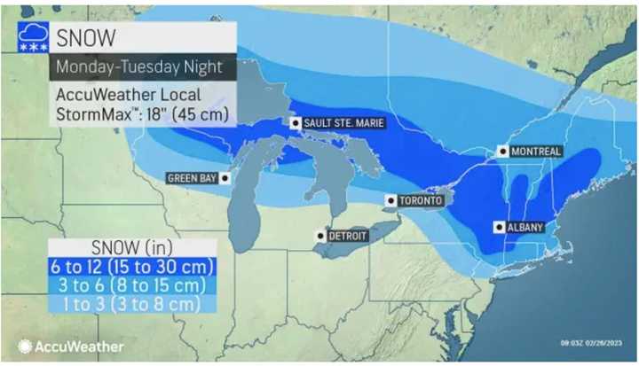
After a partly sunny start to the day, the system is currently due to arrive late Monday afternoon, Feb. 27, or early Monday evening, and continue into late in the morning on Tuesday, Feb. 28.
"This is likely to be the biggest storm of the season to date for central New England, including the Boston area and northern parts of Connecticut and Rhode Island," according to AccuWeather Senior Meteorologist and New England native Joe Lundberg.
In those spots, up to 6 inches or more of snowfall is possible. Several inches of snowfall is expected elsewhere in the region.
For a look at projected snowfall see the image above from AccuWeather.com: 1 to 3 inches (light blue), 3 to 6 inches (Columbia blue), and 6 to 12 inches (blue).
Ahead of the storm, Sunday, Feb. 26 will be partly sunny with a high temperature in the mid-40s with wind-chill values in the 20s in the morning, according to the National Weather Service.
Snow could continue at times into late Tuesday morning before the high temperature climbs into the upper 30s on a mostly cloudy day.
Temperatures will then increase during the middle of the week.
Wednesday, March 1 will be mostly sunny with a high temperature in the mid-40s.
The high temperature on Thursday, March 2 will reach the mid-50s with a chance for rain.
Check back to Daily Voice for updates.
Click here to follow Daily Voice Bedford and receive free news updates.
