A new winter storm taking aim on the Northeast is expected to bring a mix of snow, sleet, and rain to the region.
The time frame for the storm system's impact in this area is Saturday night, March 5 into Sunday morning, March 6.
Wednesday, March 2 will be mostly sunny with a high temperature in the mid 40s. Skies will become cloudy at night with a round of rain and snow showers possible late in the evening.
Thursday, March 3 will be partly cloudy with a high temperature in the mid 30s and wind-chill values between 20 and 30 degrees.
Friday, March 4 will be sunny with a high temperature in the mid 30s.
It will be mostly cloudy during the day on Saturday prior to the storm system's arrival. The high temperature will be around 40 degrees before dipping to around 30 degrees overnight into Sunday.
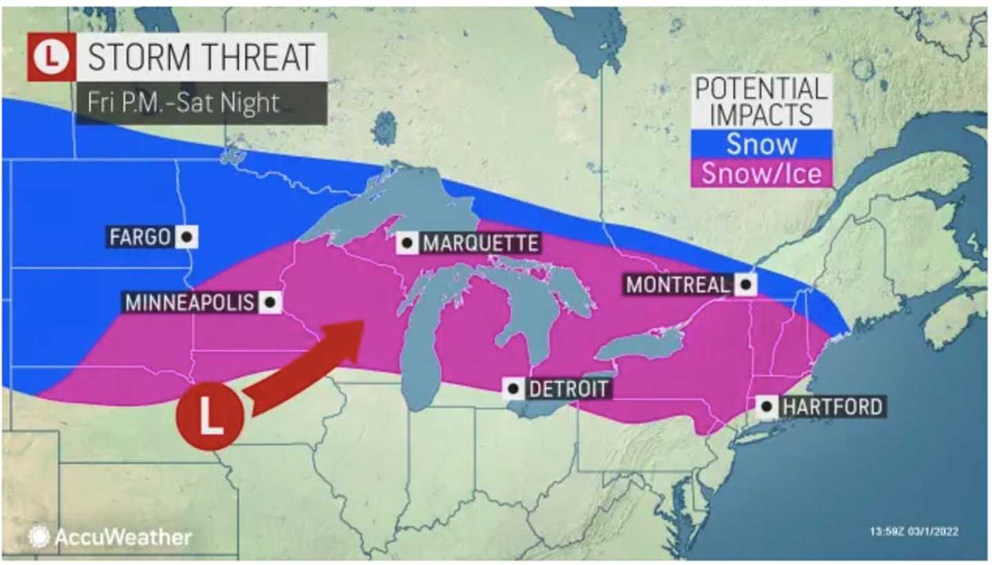
For a look at areas where snow and ice are possible (shown in pink) and snow (shown in blue) are expected, see the image above from AccuWeather.com.
There's still uncertainty surrounding the strength and track of the storm, and it's too early to predict possible snowfall amounts.
In areas where there is a wintry mix and snow, precipitation will change to rain quickly after daybreak Sunday as the high temperature is expected to climb into the 50s with cloudy skies throughout the day.
Check back to Daily Voice for updates.
Click here to follow Daily Voice Bedford and receive free news updates.