“Please don’t think to yourself, ‘I’ve been through this before, I know this.’ You probably have never seen anything like this in your life,” Parker added.
“This is an enormous atmospheric disturbance,” he said. “It’s tremendous. It’s going to go on for a long time.”
- NJ News Commons, based at Montclair State, is pulling together information from various news sources across the state, including CLIFFVIEW PILOT. For the latest:
Citing the high winds and “life-threatening storm surge,” New York Gov. Andrew M. Cuomo said this morning that subway, bus, and railroad service will be suspended beginning at 7 tonight. The shutdown is expected to continue through Tuesday.
A surge of up to 11 feet is expected along Raritan Bay and the Long Island Sound, according to the National Hurricane Center. That means potentially disastrous flooding for the tri-state area.
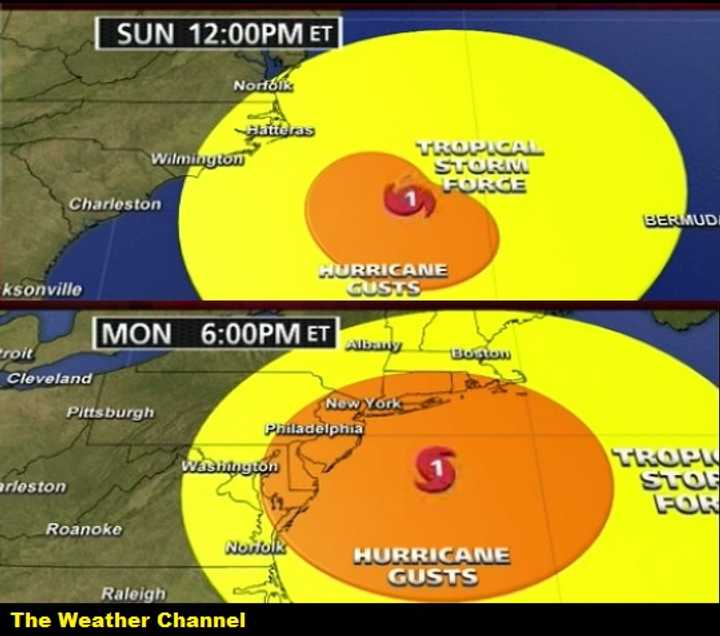
No one can say for sure how it’s going to play out. Although a planned left hook was expected, landfall is now predicted for late Monday or early Tuesday.
That said, Sandy’s impact has already begun and is expected to stretch from the mid-Atlantic to New England and as far inland as the Ohio Valley.
(That the tropical storm warning stretched all the way to Bermuda provides some indication of its mammoth size.)
Add to it a winter storm system from the west and arctic air from Canada that are both expected to merge with Sandy — as well as Monday’s full moon, which is raising tides — and you’ve pretty much taken out some of the guesswork: This could be The Big One.
Cuomo said he hoped shutting down Metropolitan Transportation Authority operations would discourage people in New York and the surrounding states from being “up and about” when Sandy’s full force hits the tri-state area.
Meanwhile, Gov. Christie warned us to be ready to go a week to 10 days without power.
Click here to follow Daily Voice Teaneck and receive free news updates.
