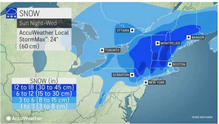
Though it's "Spring Forward" time, a potent storm that will be packed with a mix of snow, sleet, rain, and strong winds that could cause power outages is headed to the region.
The time frame for the storm is Monday, March 13 into Tuesday, March 14, according to the National Weather Service.
It will be the second winter storm in the span of days as the weekend is off to a messy storm thanks to a system that is now gradually winding down after bringing light snow to much of the region Saturday morning, March 11. Some areas farther west and north have seen as much as 6 inches of snowfall.
Saturday will be cloudy throughout the day with a high temperature of around 40 degrees but colder wind-chill values.
Skies will clear overnight, leading to a mostly sunny day on Sunday with a high temperature in the mid-40s and wind-chill values in the 20s.
With a high temperature of around 40 degrees on Monday, precipitation from the Nor'easter will arrive as rain, with up to a half-inch of precipitation possible before a changeover to a wintry mix into Tuesday. Northern and Central PA will get mostly snow while New Jersey will likely get mostly rain, weather maps show.
Areas across eastern PA and all of New Jersey are subject to heavy winds and possible power outages, according to AccuWeather.
Wednesday, March 15 should be partly sunny and breezy with a high temperature of around 40 degrees.
Click here to follow Daily Voice Mahwah-Ramsey and receive free news updates.

