Find Your Daily Voice
 45°
45°
These Areas Will See Heaviest, Steadiest Rainfall, Strongest Winds From Coastal Storm System
A coastal storm system will bring a mix of showers, rain, drenching downpours, and gusty winds to much of the region.
Rainfall will begin Sunday afternoon, Oct. 23, and continue at times through the evening and into the overnight hours, according to the National Weather Service.
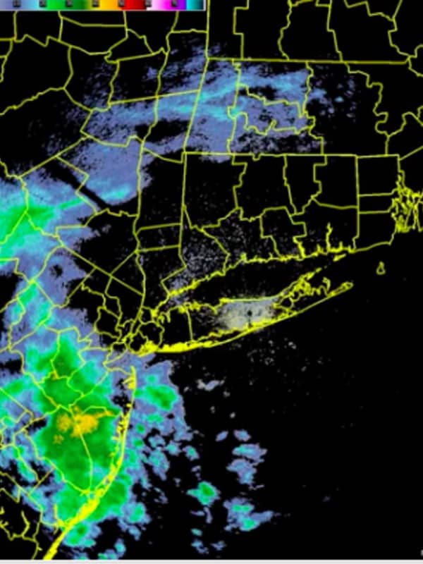
Sunday will be cloudy throughout the day, with the storm system advancing from the southeast to the north. (See the first image above.)
The high temperature will be in the low 60s.
The heaviest and steadiest rain from the tropical system is likely in southeastern New England and eastern Long Island, where a gene…
Brace For Isolated Twisters, Flash Flooding Across NJ, Forecasters Say
Up to three inches of rain, flash flooding and damaging winds were expected Thursday across New Jersey.
A flash flood watch was in effect for Bergen, Essex, Hudson, Hunterdon, Mercer, Middlesex, Morris, Passaic, Somerset, Sussex, Union and Warren counties Thursday morning into Friday.
Severe thunderstorms with potential for isolated twisters were also possible, the National Weather Service says.
The main threat was expected midday Thursday into the early overnight hours, the NWS says.
Storms were, however, expected to move out quickly Friday.
Stormy Sunday, Monday: Cold With Rainfall Up To 3 Inches, Coastal Flooding
Don't adjust your calendar.But it definitely does feel more like mid-February than mid-April, especially following a stretch of back-to-back days of true spring weather.
That trend will continue the next couple of days with heavy rain, possible thunderstorms, brisk winds and even the possibility of freezing rain in areas farther north.
The potential for pockets of freezing rain and drizzle into Sunday evening, mainly in higher elevations, is for Northern Westchester, Putnam Dutchess, Rockland, Orange, Northern Fairfield and Western Passaic. A glaze of ice accretion is possible.
A period of…