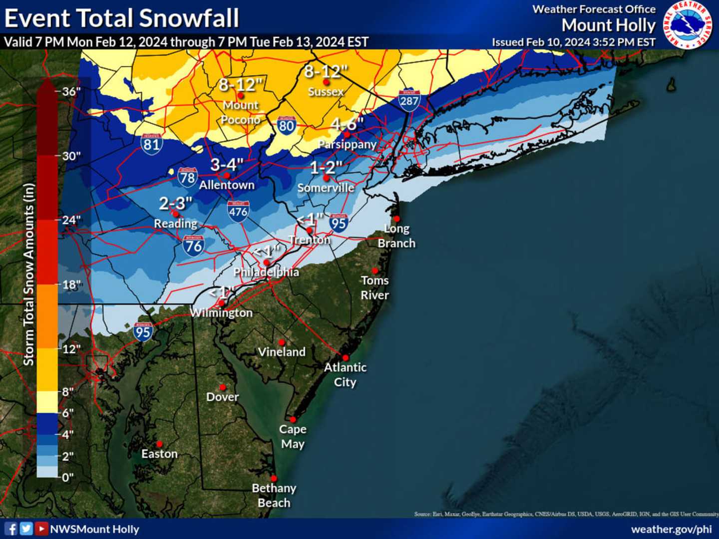
The National Weather Service's new map shows between 8 and 12 inches of snow could fall in parts of Sussex, Passaic, Bergen, Morris and Warren counties. Parts of the Poconos could see the same.
Snowfall is expected to begin Monday evening, Feb. 12 as a wintry mix and change to snow overnight across North Jersey, the Jersey Shore, and southeastern Pennsylvania/greater Philadelphia.
"It will snow in New York City, but probably not until near the very end of the storm on Tuesday," AccuWeather Chief On-Air Meteorologist Bernie Rayno said.
"The snowfall accumulation from the storm depends on whether the second part of the storm can tap enough cold air," the AccuWeather report continues.
"A weaker storm that fails to gather cold air and tracks farther to the south may fail to produce much snow. If the storm intensifies rapidly near the Northeast coast, rain may transition to heavy, accumulating snow in the zone from New York City to Philadelphia and perhaps Washington, D.C."
See weather map above to see how much snow your town could get.
Super Bowl Sunday will be partly cloudy with temps in the mid-40s. Monday, Feb. 12 will be partly sunny with a high near 50. Temps will drop Monday night to the 30s at which point rain will fall and change over to snow, according to the NWS.
Tuesday, Feb. 13 will be snowy and breezy.
The Jersey Shore and South Jersey will see mostly rain, the NWS said.
Check back to Daily Voice for updates.
Click here to follow Daily Voice Mahwah-Ramsey and receive free news updates.