A much warmer, soggier stretch will kick off with a bang as severe thunderstorms threaten parts of the Northeast.
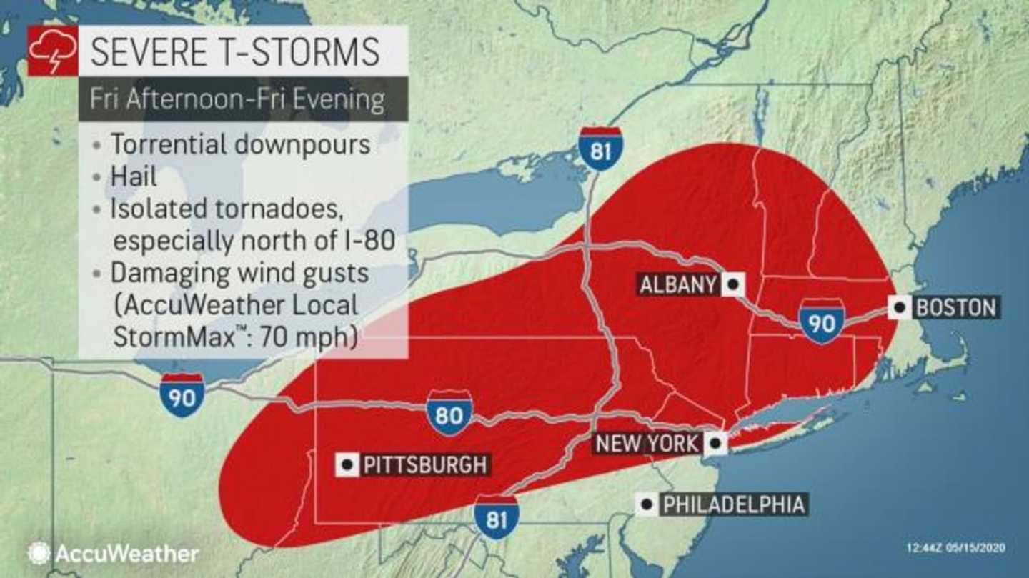
"Thunderstorms will erupt Friday afternoon ahead of a cold front across parts of Ohio, northwestern Pennsylvania and upstate New York then charge east and southeastward into portions of New England, the lower Hudson Valley and central and eastern Pennsylvania into the early evening hours," AccuWeather Senior Meteorologist Joe Lundberg said.
Damaging winds, torrential downpours and hail will be the main threats.
"The warmth and humidity that will help to fuel these strong storms will come just a day and half after widespread frost and even some freezes in parts of the interior Northeast," Lundberg said.
Farther southeast, along the Interstate 95 corridor, thunderstorms won't arrive until early evening and likely won't depart until after dark, leaving most of Friday dry and feeling more like a "summer tease."
“New York City and Philadelphia will have their warmest days of the year so far on Friday. Philadelphia will soar past 80 degrees, making it their first 80-degree day of the year,” AccuWeather Senior Meteorologist Dave Dombek said.
Even though the polar vortex will retreat and winterlike cold isn't expected to return, unsettled weather will dampen the region and keep it cooler than normal much of next week.
READ THE FULL STORY: https://www.accuweather.com/en/severe-weather/warming-trend-to-trigger-severe-weather-outbreak-across-large-part-of-northeast/739795
Click here to follow Daily Voice Hackensack and receive free news updates.