In coastal areas along the I-95 corridor, mainly rain and possible sleet are expected from the system on track for Thursday, Dec. 15 into Friday, Dec. 16, according to the National Weather Service.
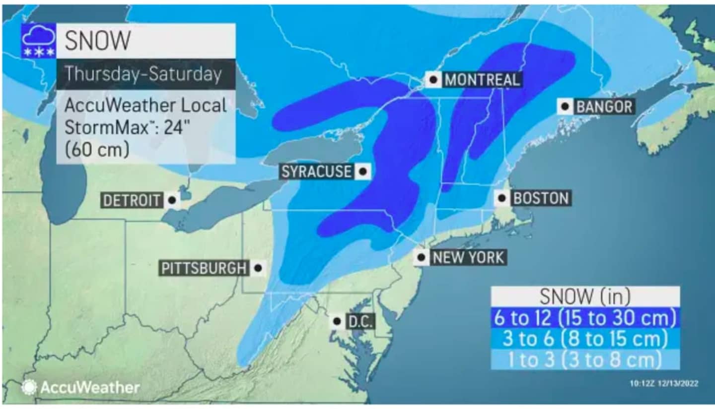
One and three inches is likely the most that parts of North Jersey will get, while the Poconos and Central PA could see between four and six inches, AccuWeather.com says.
The Baltimore/Washington DC/Northern Virginia region will likely see the storm start as a mix of rain and snow on Wednesday evening, but that will transition into rain on Thursday, the National Weather Service says.
Projected accumulation totals are pictured on the map above.
It will be mainly sunny on Tuesday, Dec. 13 with a high temperature in the upper 30s to low 40s, but colder wind-chill values. Look for sunny skies Wednesday, Dec. 14 with a high temperature in the mid 30s.
The storm system is due to arrive sometime after midday Thursday before winding down late Friday night or in the early morning hours on Saturday, Dec. 17.
There's still uncertainty surrounding the track and strength of the new system.
Click here to follow Daily Voice Hackensack and receive free news updates.