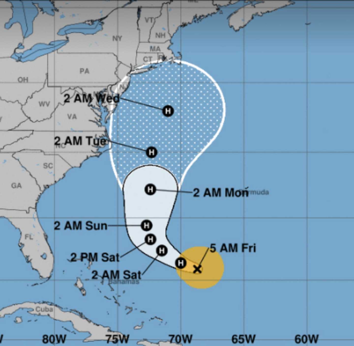

The so-called cone of uncertainty for Hurricane turned Tropical Storm Jose shows the storm tracking toward the metropolitan area Tuesday night into Wednesday.
With maximum sustained winds of 70 mph, Jose is expected to regain strength over the weekend and become a hurricane again. At one point last week, it was a Category 4 hurricane, the same strength as Irma and Harvey when they made landfall on the U.S. the last few weeks.
After completed an unusual clockwise loop, Jose is now forecast to move closer to the U.S. mainland before trekking north.
People in coastal areas of the Northeast will need to monitor the progress of Jose, according to AccuWeather.com.
A hurricane does not need to make landfall to cause significant adverse effects in the northeastern U.S., since the shape of the coast tends to enhance storm effects and trap ocean water.
Check back to Daily Voice for updates on Jose's path.
For more on the storm, check the National Hurricane Center's page devoted to Jose here.
Click here to follow Daily Voice Hackensack and receive free news updates.