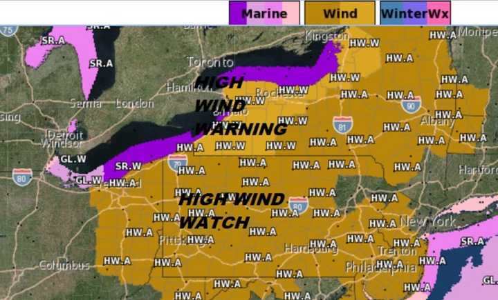
And according to North Jersey's premiere meteorologist, sustained winds of 20 to 35 mph will start kicking up Sunday afternoon and continue, nonstop, well into Monday.
Gusts will hit more than 50 mph -- a last, powerful gasp from winter and the first genuine sign that spring is on its way, Joe Cioffi said.
Unfortunately, that means downed trees and utility lines, along with the power outages and driving risks they bring.
This follows a Saturday night rainstorm, offering “wind-blown hair, hat hair, and bad hair weather all wrapped up into one this weekend,” Cioffi said.
“Strong storms and big wind events are typical of this time of year,” Cioffi said.
“Gusts over 50 mph will be commonplace when this is all said and done,” he said. “We will blow away Sunday night into Monday night and those winds will howl.
“I would not be surprised at all to see trees down and power outages.”
Cioffi said we can “expect heavy rain to arrive on our doorstep” Saturday afternoon into evening – and continuing into Sunday morning, with as much as one to two inches.
“Don’t rule out a thunderstorm, either,” he said.
Then comes a Sunday afternoon calm before the cold winds blow.
“We will have a mix of sun and clouds Monday, but it will be cold, with temperatures in the 30s and wind chills down in the teens,” Cioffi said.
“Winds should finally begin to subside on Tuesday with some sunshine and highs back into the 40s,” he said.
There’s better news: March just might not come in like a lion.
“Unless the stars line up just right in the next two weeks, the snow threats may be done for the season and it is on to spring,” Cioffi said. “We shall see.”
DOWNLOAD: Joe Cioffi's Weather App For All Devices
Click here to follow Daily Voice Hackensack and receive free news updates.
