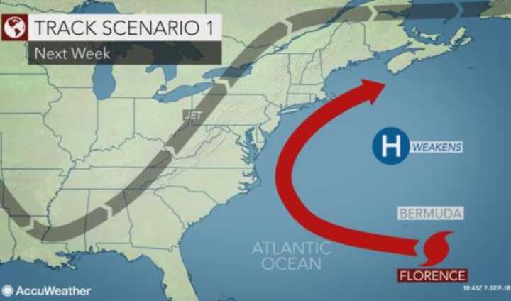
There's a good chance that Florence -- which formed near the Cabo Verde Islands last weekend -- could curve northward and then out to sea, producing only rough surf, strong rip currents and large offshore swells, AccuWeather.com reported.
Effects along the East Coast could begin to be felt this weekend, the NOAA’s National Hurricane Center warned.
On the other hand, meteorologists said Florence "may evolve into a serious direct threat" and make landfall somewhere between southern New England the Carolinas next Wednesday or Thursday, AccuWeather.com reported.
That would mean "severe consequences in terms of wind damage, coastal storm surge and inland flooding from torrential rainfall," it said.
It also would put Bermuda directly in Florence's path.
"There is still very large uncertainty in Florence’s track beyond Day 5," the National Hurricane Center emphasized, "and it is too soon to determine what, if any, other impacts Florence could have on the U.S. East Coast next week.”
Florence became the first Category 4 hurricane of the 2018 Atlantic season before slowing down a bit -- with its maximum sustained winds decreasing to near 65 mph, the NOAA reported.
However, both the NHC and AccuWeather said experts expect her to gain strength this weekend and become a hurricane again as she moves over much warmer water on what's expected to be a 3,500-mile trip.
Click here to follow Daily Voice Hackensack and receive free news updates.


