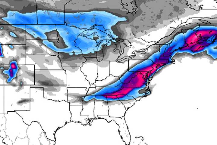
Jonathan Carr of Facebook’s Severe NJ Weather emphasizes that he’s not a meteorologist but says we could be looking at “a foot plus of snow from DC through NYC” that “looks to start late Wednesday night and last well into Thursday. That includes most of SWNJ, CNJ, and NENJ.
“Sharp cutoff for NWNJ,” he added, “but still a significant event.”
He revised that around 6 p.m. today, saying the maps show as much as TWENTY INCHES from Baltimore through New York City.
Others says all that’s afoot is some gun-jumping.
“It’s very likely that we’ll experience a storm,” Justin Auciello of Facebook’s Jersey Shore Hurricane News said earlier today. “But the track determines how much snow will fall and where.”
From the National Weather Service office in New York:
“A closer to the coast track will bring in warmer air and precipitation type issues (snow to changing to rain or a rain/snow mix) and a track further offshore would mean colder air but less in the way of precipitation. As the track and intensity becomes better resolved, we will have a better idea of amounts.”
As Auciello says: “You’ll see various models flying around social media today. Keep in mind that precipitation types and amounts are still up in the air.
“Forecasters will likely have a better handle on the situation tonight or early tomorrow.”
Or, better yet: Wednesday morning.
Regardless, “storm preparation is always an excellent idea,” Auciello added.
NOTE: With more than 200,000 likes, Jersey Shore Hurricane News is one of the most successful social media news sites in the world. Since its inception in the days preceding Hurricane Irene, the CLIFFVIEW PILOT news partner has quickly jetted into covering breaking news, traffic, weather, and community-oriented news throughout the state — as it happens. The secrets to success for founder/operator/Editor-in-Chief Justin Auciello (photo) have been his dedication to his audience and the tips, photos and information that they, in turn, share. Auciello’s motto: “News for the people, by the people.”
CLICK HERE to go to:
Jonathan Carr of Severe NJ Weather writes: It’s important for you to know that I’m not a professional meteorologist. I have no formal education in meteorology nor climatology. I’m simply a weather enthusiast with a self-taught knowledge who loves to share my passion with the public. I do this on my own free time in the interest of aggregating public safety awareness…not as a weather forecasting business.
CLICK HERE to go to: SEVERE NJ WEATHER:
Click here to follow Daily Voice Hackensack and receive free news updates.


