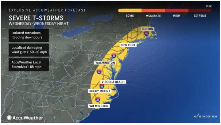
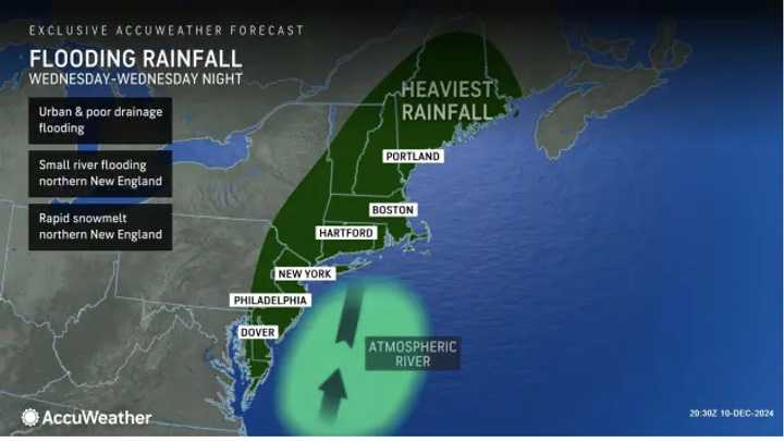
The National Weather Service says the storm, which will accompany a cold front, will move from the southwest to the east on Tuesday night, Dec. 10, into Wednesday, Dec. 11. See the first image above from AccuWeather.
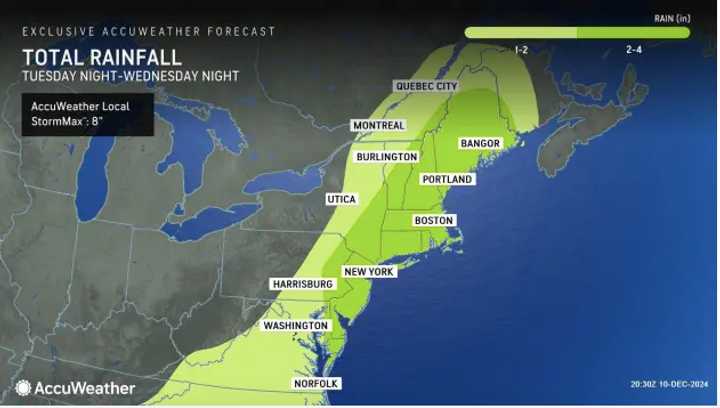
The storm will bring widespread rainfall of 1 to 2 inches, with 2 to 4 inches in the areas indicated by the darker shade of green in the second image above from AccuWeather.com in projections released Tuesday.
During the storm's height, there will be heavy rain and wind gusts between 25 and 30 miles per hour.
Some areas, especially along coastal areas of the Northeast, could see gusts of between 50 and 60 mph.
"Wednesday is shaping up to be a very wet day up and down the I-95 corridor from northern Florida all the way to Maine," AccuWeather Senior Meteorologist Bill Deger said.
Rainfall will begin tapering off Wednesday night, according to the National Weather Service.
After the frontal system pushes through, it will be mostly sunny and colder on Thursday, Dec. 12.
Check back to Daily Voice for updates.
Click here to follow Daily Voice Pasadena-Lake Shore and receive free news updates.


